Overview
Makalu is 8,485 metres, the fifth-highest mountain on earth, and it sits between the Khumbu and Kanchenjunga in a national park almost nobody visits. Makalu Barun runs from 400 metres of subtropical forest to the summit in about forty kilometres — the greatest altitude range of any protected area in the world.
Eighteen days, no restricted permit, and a few hundred trekkers a year.
The route
From Num the trail drops 860 metres to the Arun and climbs straight back out — which is the trek in miniature. Up through Seduwa and Tashigaon, then 1,460 metres in a single day to Khongma Danda.
The Shipton La chain — four passes between 4,100 m and 4,220 m — crosses into the Barun valley, and from there it is a long walk up the valley floor to Makalu Base Camp at 4,870 m.
What base camp gives you
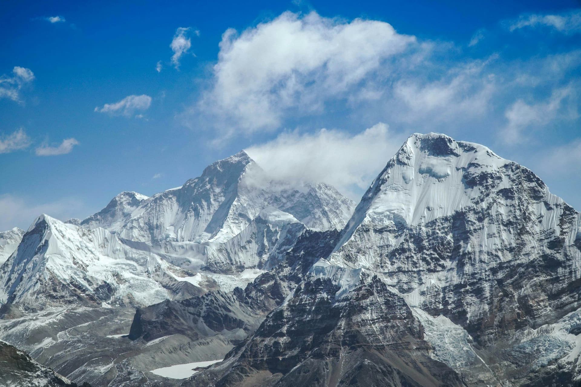
Makalu fills the head of the valley, a kilometre and a half above you. But the reason to climb the moraine ridge behind camp is what is behind you to the west: the Kangshung and south faces of Everest and Lhotse, from an angle no other trekking route in Nepal reaches.
What it costs in effort
Around 8,600 metres of cumulative ascent, against roughly 5,800 on Everest Base Camp at a similar maximum altitude. The route will not let you gain height and keep it — it drops into valleys and climbs out again, repeatedly.
Above Tashigaon the lodges are shelters: a platform, a fire, no menu. Bring a bag good to −15°C.
Access
Fly Kathmandu to Tumlingtar, then five hours by jeep to Num on a road that closes for landslides. Keep spare days at both ends.
Best season
March to May and October to November. Spring brings rhododendron through the lower forest and more haze up high; autumn gives the clear air. The pass chain takes snow early and holds it late.
Day by day
The 18 days itinerary
Distances, walking times, altitudes and accommodation for every stage — stored as structured data, not written into the prose.
- Day 1
Kathmandu to Tumlingtar, drive to Num
Kathmandu (1,400 m) → Tumlingtar (400 m) → Num (1,560 m)
- Walking
- 45 min flight, 5 hours by jeep
- Altitude
- 1,400 m → 1,560 m
- Sleep
- Lodge, Num
- Meals
- Lunch, dinner
A short flight into the Arun valley and then a long, rough jeep ride north on a road that is regularly closed by landslides.
- Day 2
Num to Seduwa
Num (1,560 m) → Arun river (700 m) → Seduwa (1,540 m)
- Distance
- 12 km
- Walking
- 6 hours
- Altitude
- 1,560 m → 1,540 m
- Elevation
- +850 m / −870 m
- Sleep
- Lodge, Seduwa
- Meals
- Breakfast, lunch, dinner
Down 860 metres to the Arun and straight back up the other side. This day sets the tone: the Makalu trek loses and regains altitude constantly.
- Day 3
Seduwa to Tashigaon
Seduwa (1,540 m) → Tashigaon (2,100 m)
- Distance
- 12 km
- Walking
- 6 hours
- Altitude
- 1,540 m → 2,100 m
- Elevation
- +700 m / −140 m
- Sleep
- Lodge, Tashigaon
- Meals
- Breakfast, lunch, dinner
The last real village. Above here the lodges are shelters.
- Sherpa villages
- Terraced millet and cardamom
- Day 4
Tashigaon to Khongma Danda
Tashigaon (2,100 m) → Khongma Danda (3,560 m)
- Distance
- 8 km
- Walking
- 7 hours
- Altitude
- 2,100 m → 3,560 m
- Elevation
- +1460 m
- Sleep
- Shelter, Khongma Danda
- Meals
- Breakfast, lunch, dinner
1,460 metres of climbing in one day through rhododendron forest, much of it on steps. The hardest ascent on the trek.
- Day 5
Acclimatisation at Khongma Danda
Khongma Danda (3,560 m)
- Walking
- 4 hours
- Altitude
- 3,560 m → 3,560 m
- Sleep
- Shelter, Khongma Danda
- Meals
- Breakfast, lunch, dinner
- Day 6
Khongma Danda over the passes to Dobato
Khongma Danda (3,560 m) → Shipton La (4,216 m) → Keke La (4,127 m) → Dobato (3,800 m)
- Distance
- 12 km
- Walking
- 8 hours
- Altitude
- 3,560 m → 3,800 m
- Elevation
- +900 m / −660 m
- Sleep
- Shelter, Dobato
- Meals
- Breakfast, lunch, dinner
Four passes in a chain — Ghungru La, Tutu La (Shipton La), Keke La — with Makalu appearing suddenly at the top. Exposed and often snowbound.
- Shipton La
- Keke La
- First Makalu view
- Chamlang
- Day 7
Dobato to Yangle Kharka
Dobato (3,800 m) → Yangle Kharka (3,600 m)
- Distance
- 11 km
- Walking
- 6 hours
- Altitude
- 3,800 m → 3,600 m
- Elevation
- +600 m / −800 m
- Sleep
- Shelter, Yangle Kharka
- Meals
- Breakfast, lunch, dinner
Down into the Barun valley proper, and a long walk up its floor.
- Day 8
Yangle Kharka to Langmale Kharka
Yangle Kharka (3,600 m) → Langmale Kharka (4,410 m)
- Distance
- 12 km
- Walking
- 6 hours
- Altitude
- 3,600 m → 4,410 m
- Elevation
- +810 m
- Sleep
- Shelter, Langmale Kharka
- Meals
- Breakfast, lunch, dinner
- Barun valley walls
- Waterfalls
- Peak 6 and Peak 7
- Day 9
Langmale Kharka to Makalu Base Camp
Langmale Kharka (4,410 m) → Shershong → Makalu Base Camp (4,870 m)
- Distance
- 10 km
- Walking
- 6 hours
- Altitude
- 4,410 m → 4,870 m
- Elevation
- +460 m
- Sleep
- Shelter, Makalu Base Camp
- Meals
- Breakfast, lunch, dinner
- Makalu south-east face
- Barun Glacier
- Baruntse
- Day 10
Base camp exploration day
Makalu Base Camp (4,870 m) → viewpoint (5,250 m) → base camp
- Distance
- 8 km
- Walking
- 6 hours
- Altitude
- 4,870 m → 4,870 m
- Elevation
- +380 m / −380 m
- Sleep
- Shelter, Makalu Base Camp
- Meals
- Breakfast, lunch, dinner
A climb onto the moraine ridge above camp. On a clear morning Everest and Lhotse show their Kangshung and south faces — a view no other trekking route in Nepal offers.
- Everest and Lhotse south faces
- Makalu at close range
- Barun Glacier
- Day 11
Base Camp to Yangle Kharka
Makalu Base Camp (4,870 m) → Yangle Kharka (3,600 m)
- Distance
- 22 km
- Walking
- 8 hours
- Altitude
- 4,870 m → 3,600 m
- Elevation
- −1270 m
- Sleep
- Shelter, Yangle Kharka
- Meals
- Breakfast, lunch, dinner
- Day 12
Yangle Kharka to Dobato
Yangle Kharka (3,600 m) → Dobato (3,800 m)
- Distance
- 11 km
- Walking
- 6 hours
- Altitude
- 3,600 m → 3,800 m
- Elevation
- +800 m / −600 m
- Sleep
- Shelter, Dobato
- Meals
- Breakfast, lunch, dinner
- Day 13
Dobato over the passes to Khongma Danda
Dobato (3,800 m) → Keke La → Shipton La → Khongma Danda (3,560 m)
- Distance
- 12 km
- Walking
- 8 hours
- Altitude
- 3,800 m → 3,560 m
- Elevation
- +660 m / −900 m
- Sleep
- Shelter, Khongma Danda
- Meals
- Breakfast, lunch, dinner
- Day 14
Khongma Danda to Tashigaon
Khongma Danda (3,560 m) → Tashigaon (2,100 m)
- Distance
- 8 km
- Walking
- 5 hours
- Altitude
- 3,560 m → 2,100 m
- Elevation
- −1460 m
- Sleep
- Lodge, Tashigaon
- Meals
- Breakfast, lunch, dinner
- Day 15
Tashigaon to Seduwa
Tashigaon (2,100 m) → Seduwa (1,540 m)
- Distance
- 12 km
- Walking
- 5 hours
- Altitude
- 2,100 m → 1,540 m
- Elevation
- +140 m / −700 m
- Sleep
- Lodge, Seduwa
- Meals
- Breakfast, lunch, dinner
- Day 16
Seduwa to Num
Seduwa (1,540 m) → Arun river (700 m) → Num (1,560 m)
- Distance
- 12 km
- Walking
- 6 hours
- Altitude
- 1,540 m → 1,560 m
- Elevation
- +870 m / −850 m
- Sleep
- Lodge, Num
- Meals
- Breakfast, lunch, dinner
- Day 17
Num to Tumlingtar
Num (1,560 m) → Tumlingtar (400 m)
- Walking
- 5 hours by jeep
- Altitude
- 1,560 m → 400 m
- Sleep
- Guesthouse, Tumlingtar
- Meals
- Breakfast, dinner
- Day 18
Tumlingtar to Kathmandu
Tumlingtar (400 m) → Kathmandu (1,400 m)
- Walking
- 45 minutes by air
- Altitude
- 400 m → 1,400 m
- Meals
- Breakfast
Route map
Where the trail goes
Route line, start and end points, and every overnight stop. Locations are shared entities — the same record powers the destination and itinerary pages.
Frequently asked questions
Why do so few people trek Makalu?
What can you see from base camp that you cannot elsewhere?
How hard is it compared with Everest Base Camp?
What are the lodges like?
Is the Barun valley protected?
About the author
Tom Eriksen
Gear editor & photographer
Tom tests trekking equipment the only way that produces honest answers: by carrying it for weeks at a time above 4,000 metres. He shoots most of the photography on this site and writes the gear reviews, comparison tables and packing lists.
Writes about: Trekking gear · Photography · Packing and weight