Overview
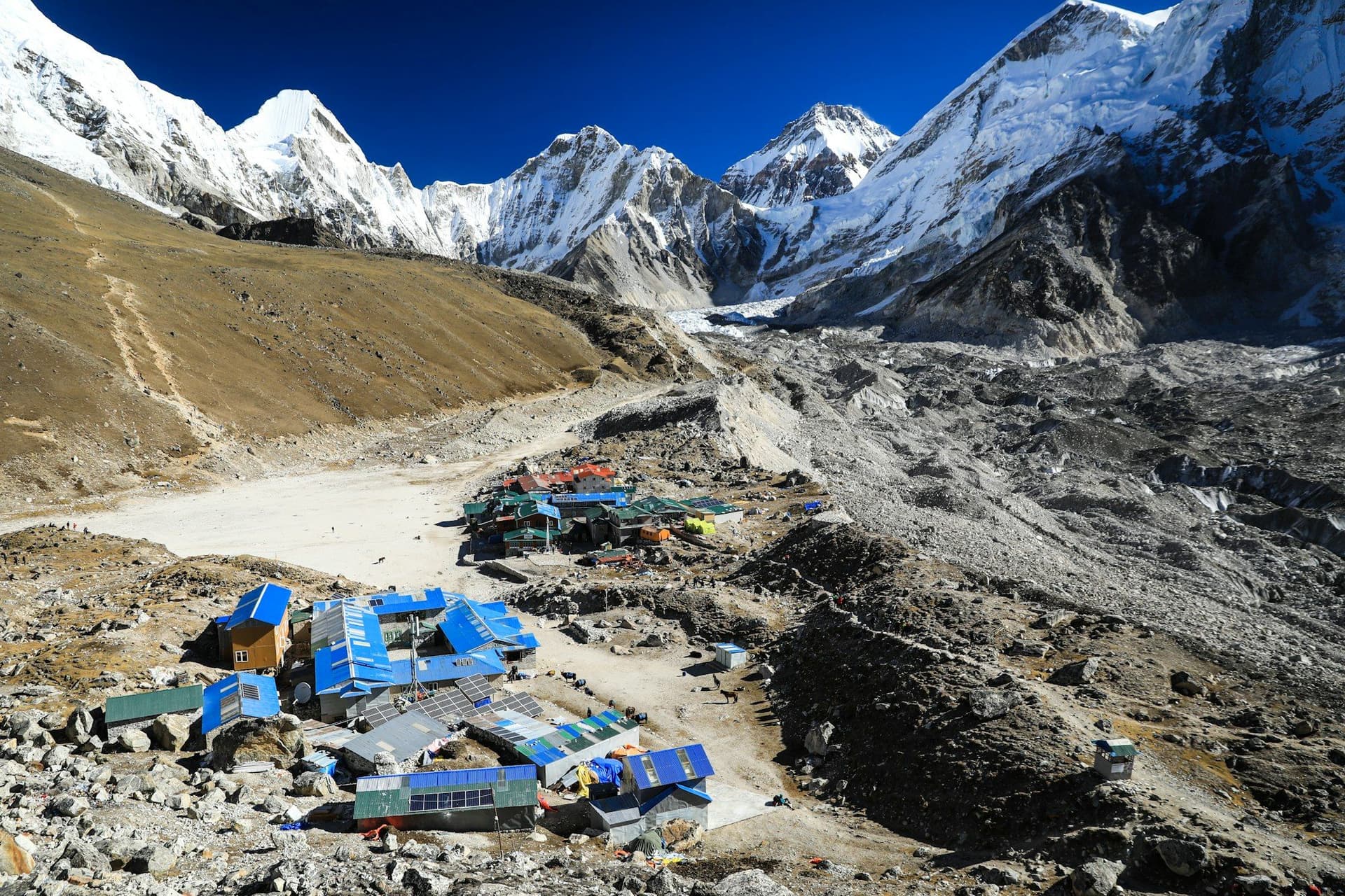
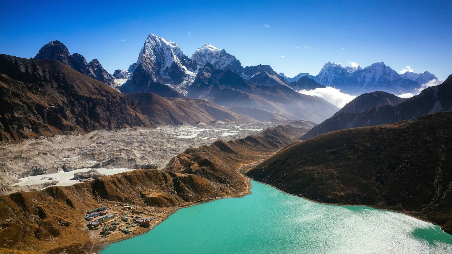
The Three Passes is the complete Khumbu. It links the three main valleys of the region — Imja, Khumbu and Gokyo — by crossing the passes that separate them, and takes in Everest Base Camp, Kala Patthar, the Gokyo lakes and Gokyo Ri along the way.
It is a serious undertaking. Kongma La (5,535 m) is the highest and least travelled, and finishes with a crossing of the Khumbu glacier. Cho La (5,420 m) involves a short glacier section where microspikes or crampons are often needed. Renjo La (5,360 m) is the easiest of the three and gives the best Everest view of the lot.
Twenty days, three weeks of food and lodging, and a level of altitude exposure that assumes you have done something like Everest Base Camp already.
Day by day
The 20 days itinerary
Distances, walking times, altitudes and accommodation for every stage — stored as structured data, not written into the prose.
- Day 1
Fly to Lukla, trek to Phakding
Lukla (2,860 m) → Phakding (2,610 m)
- Distance
- 8 km
- Walking
- 3 hours
- Altitude
- 2,610 m
- Sleep
- Teahouse, Phakding
- Day 2
Phakding to Namche Bazaar
Phakding (2,610 m) → Namche Bazaar (3,440 m)
- Distance
- 10.5 km
- Walking
- 6 hours
- Altitude
- 3,440 m
- Elevation
- +830 m
- Sleep
- Teahouse, Namche Bazaar
- Day 3
Namche acclimatisation
Namche → Everest View Hotel (3,880 m) → Namche
- Distance
- 5 km
- Walking
- 4 hours
- Altitude
- 3,440 m
- Sleep
- Teahouse, Namche Bazaar
- Day 4
Namche to Tengboche
Namche (3,440 m) → Tengboche (3,867 m)
- Distance
- 9.5 km
- Walking
- 5 hours
- Altitude
- 3,867 m
- Sleep
- Teahouse, Tengboche
- Day 5
Tengboche to Dingboche
Tengboche (3,867 m) → Dingboche (4,410 m)
- Distance
- 11 km
- Walking
- 5 hours
- Altitude
- 4,410 m
- Sleep
- Teahouse, Dingboche
- Day 6
Dingboche acclimatisation
Dingboche → Nangkartshang (5,083 m) → Dingboche
- Distance
- 5 km
- Walking
- 4 hours
- Altitude
- 4,410 m
- Sleep
- Teahouse, Dingboche
- Day 7
Cross Kongma La to Lobuche
Chhukung (4,730 m) → Kongma La (5,535 m) → Lobuche (4,940 m)
- Distance
- 12 km
- Walking
- 9 hours
- Altitude
- 4,730 m → 4,940 m
- Elevation
- +805 m / −595 m
- Sleep
- Teahouse, Lobuche
The toughest day of the trek and the least travelled of the three passes. The far side involves crossing the Khumbu glacier itself on loose moraine.
- Kongma La — the highest and hardest of the three passes
- Khumbu glacier crossing
- Day 8
Everest Base Camp and Gorak Shep
Lobuche (4,940 m) → Gorak Shep (5,164 m) → EBC (5,364 m) → Gorak Shep
- Distance
- 13 km
- Walking
- 8 hours
- Altitude
- 5,164 m
- Sleep
- Teahouse, Gorak Shep
- Day 9
Kala Patthar, then Dzongla
Gorak Shep → Kala Patthar (5,545 m) → Dzongla (4,830 m)
- Distance
- 15 km
- Walking
- 8 hours
- Altitude
- 4,830 m
- Sleep
- Basic lodge, Dzongla
- Day 10
Cross Cho La to Thagnak
Dzongla (4,830 m) → Cho La (5,420 m) → Thagnak (4,700 m)
- Distance
- 13 km
- Walking
- 8 hours
- Altitude
- 4,700 m
- Elevation
- +590 m / −720 m
- Sleep
- Basic lodge, Thagnak
- Cho La glacier crossing
- Crampons useful after snow
- Day 11
Thagnak to Gokyo
Thagnak (4,700 m) → Ngozumpa glacier → Gokyo (4,790 m)
- Distance
- 8 km
- Walking
- 4 hours
- Altitude
- 4,790 m
- Sleep
- Teahouse, Gokyo
- Ngozumpa — the longest glacier in Nepal
- Gokyo lakes
- Day 12
Gokyo Ri and the fifth lake
Gokyo → Gokyo Ri (5,357 m) → Gokyo
- Distance
- 6 km
- Walking
- 5 hours
- Altitude
- 4,790 m
- Sleep
- Teahouse, Gokyo
- Four 8,000 m peaks from one summit
- Day 13
Cross Renjo La to Lungden
Gokyo (4,790 m) → Renjo La (5,360 m) → Lungden (4,380 m)
- Distance
- 14 km
- Walking
- 8 hours
- Altitude
- 4,380 m
- Sleep
- Basic lodge, Lungden
- The best Everest view of the three passes
- Day 14
Lungden to Namche via Thame
Lungden (4,380 m) → Thame → Namche Bazaar (3,440 m)
- Distance
- 20 km
- Walking
- 7 hours
- Altitude
- 3,440 m
- Sleep
- Teahouse, Namche Bazaar
- Day 15
Namche to Lukla
Namche Bazaar (3,440 m) → Lukla (2,860 m)
- Distance
- 19 km
- Walking
- 7 hours
- Altitude
- 2,860 m
- Sleep
- Teahouse, Lukla
Route map
Where the trail goes
Route line, start and end points, and every overnight stop. Locations are shared entities — the same record powers the destination and itinerary pages.
Frequently asked questions
How hard is the Three Passes trek?
Which direction should I walk it?
About the author
Maya Thapa
Senior trekking writer
Maya has walked more than 4,000 kilometres of Nepal's trail network, from the teahouse highways of the Khumbu to the restricted valleys along the Tibetan border. She writes the route guides and day-by-day itineraries, and returns to most trails every second season to re-check lodge availability, water points and trail reroutes after monsoon damage.
Writes about: Nepal trekking · High-altitude routes · Teahouse logistics