Overview
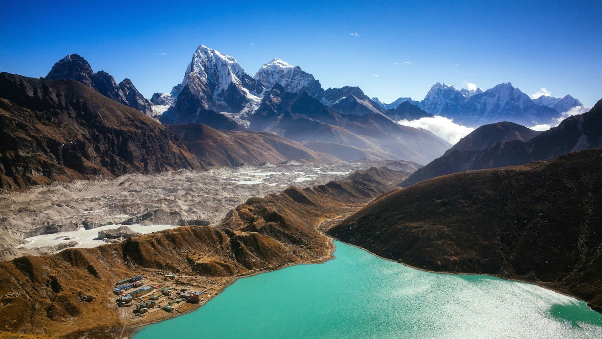
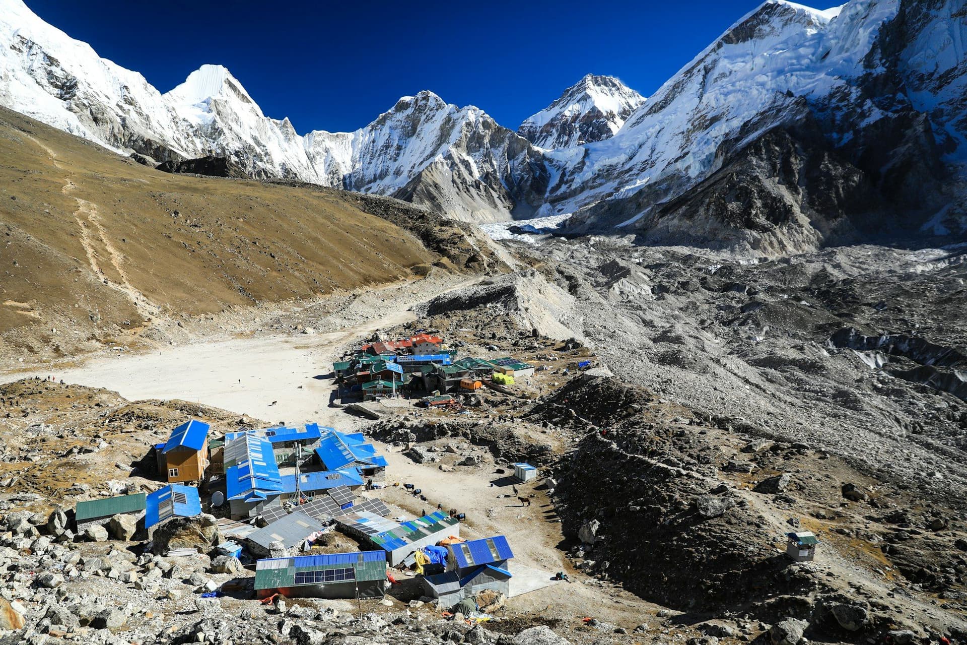
The route to Everest Base Camp is the most walked high-altitude trail on earth, and it earns the traffic. In twelve walking days you pass through pine forest, across suspension bridges over glacial rivers, through the trading town of Namche Bazaar, past a working monastery at 3,867 metres, above the tree line into open yak country, and finally onto the moraine of the Khumbu glacier beneath a 1,500-metre wall of falling ice.
What it asks of you is not skill but patience. There is no scrambling, no exposure and no technical ground. There is, however, an altitude profile that punishes anyone in a hurry, and a flight in and out of a mountain airstrip that turns schedules into suggestions.
Route
The trail runs north from Lukla up the Dudh Kosi valley, climbs the Namche Hill to the Sherpa capital, and continues along the Imja Khola to Tengboche and Dingboche. Above Dingboche it joins the Khumbu glacier's lateral moraine at Lobuche, reaches the last lodges at Gorak Shep, and finishes with two separate objectives: Base Camp itself at 5,364 m, and Kala Patthar at 5,545 m for the view of Everest that Base Camp does not provide.
The return retraces the same valley, which sounds repetitive and is not — the whole landscape reads differently walking south with the mountains behind you and oxygen returning to your blood.
Acclimatisation
This is the part of the trek that determines whether you finish it. Three rules hold up:
- Sleep no more than 500 metres higher than the night before above 3,000 m.
- Take both acclimatisation days — Namche on day 4, Dingboche on day 7. The itineraries that cut them are the ones that fail.
- Climb high, sleep low. Both rest days involve 400–700 metres of ascent followed by a descent to the same bed.
Diamox (acetazolamide) speeds acclimatisation and is widely used; discuss it with a travel doctor before you go rather than buying it in Thamel. Descend immediately and without negotiation if symptoms progress beyond a headache that responds to fluid and rest.
Costs
| Item | Independent | Guided |
|---|---|---|
| Return Lukla flight | $400–450 | Usually included |
| Permits | $40 | Usually included |
| Lodging (12 nights) | $70–130 | Included |
| Food and drink | $350–450 | Included |
| Guide | — | $360–500 |
| Porter | $250–300 | Often included |
| Total | $1,100–1,400 | $1,600–2,600 |
Two costs consistently surprise people: hot drinks, which are charged individually and add up to £8–10 a day, and charging and Wi-Fi above Namche, which is metered per device.
Best season
October and November give the most stable weather and clearest views of the year, at the cost of full lodges and busy trails. March to May is the second window — warmer, hazier, with rhododendron in flower below 3,500 m and the climbing season adding life to Base Camp.
December and January are cold but clear and remarkably quiet; nights at Gorak Shep drop below −20 °C. Avoid the June–September monsoon: cloud, leeches below Namche and a Lukla flight schedule that barely functions.
Day by day
The 14 days itinerary
Distances, walking times, altitudes and accommodation for every stage — stored as structured data, not written into the prose.
- Day 1
Kathmandu — briefing, permits and kit check
Arrive Kathmandu (1,400 m)
- Altitude
- 1,400 m
- Sleep
- Hotel, Thamel
- Meals
- Dinner
Permits are issued in Kathmandu and gear can be hired in Thamel for a fraction of the price of buying it. If your Lukla flight departs from Manthali rather than Kathmandu — common in October and April — you will be collected around 1 a.m. for the four-hour drive.
- Permit paperwork
- Final gear hire
- Day 2
Fly to Lukla, trek to Phakding
Lukla (2,860 m) → Phakding (2,610 m)
- Distance
- 8 km
- Walking
- 3–4 hours
- Altitude
- 2,860 m → 2,610 m
- Elevation
- −250 m
- Sleep
- Teahouse, Phakding
- Meals
- Breakfast, lunch, dinner
A short, downhill first day by design. You land at 2,860 m and sleep 250 metres lower, which is the correct direction of travel on day one.
- Tenzing–Hillary Airport landing
- First suspension bridges
- Day 3
Phakding to Namche Bazaar
Phakding (2,610 m) → Namche Bazaar (3,440 m)
- Distance
- 10.5 km
- Walking
- 6 hours
- Altitude
- 2,610 m → 3,440 m
- Elevation
- +830 m
- Sleep
- Teahouse, Namche Bazaar
- Meals
- Breakfast, lunch, dinner
The day divides in two: a gentle river walk to Monjo, then the Namche Hill — 600 metres of relentless switchbacks after the high suspension bridge. Weather permitting, there is a first glimpse of Everest about halfway up.
- Hillary Suspension Bridge
- National park checkpoint at Monjo
- First view of Everest
- Day 4
Namche Bazaar — acclimatisation day
Namche → Everest View Hotel (3,880 m) → Namche
- Distance
- 5 km
- Walking
- 3–4 hours
- Altitude
- 3,440 m → 3,440 m
- Elevation
- +440 m / −440 m
- Sleep
- Teahouse, Namche Bazaar
- Meals
- Breakfast, lunch, dinner
Not a rest day — an active one. Climb to the Everest View Hotel, drop into Khumjung for lunch, and return to sleep at 3,440 m. Climb high, sleep low is what makes the rest of this trek possible.
- Everest View Hotel
- Khumjung village
- Sherpa Culture Museum
- Day 5
Namche Bazaar to Tengboche
Namche (3,440 m) → Tengboche (3,867 m)
- Distance
- 9.5 km
- Walking
- 5 hours
- Altitude
- 3,440 m → 3,867 m
- Elevation
- +700 m / −270 m
- Sleep
- Teahouse, Tengboche
- Meals
- Breakfast, lunch, dinner
A contouring traverse with Ama Dablam ahead the whole way, then a drop to the river at Phunki Tenga and a 600 metre climb through rhododendron to the monastery saddle. Time your arrival for the 3 p.m. prayers.
- Ama Dablam views
- Tengboche Monastery afternoon prayers
- Day 6
Tengboche to Dingboche
Tengboche (3,867 m) → Dingboche (4,410 m)
- Distance
- 11 km
- Walking
- 5–6 hours
- Altitude
- 3,867 m → 4,410 m
- Elevation
- +620 m
- Sleep
- Teahouse, Dingboche
- Meals
- Breakfast, lunch, dinner
The last trees are behind you by mid-morning. Above Pangboche the landscape turns to scrub, stone walls and open valley, and the trail into the Imja valley gives the first head-on view of Island Peak.
- Pangboche gompa
- Tree line
- Imja valley
- Day 7
Dingboche — acclimatisation day
Dingboche → Nangkartshang (5,083 m) → Dingboche
- Distance
- 5 km
- Walking
- 4 hours
- Altitude
- 4,410 m → 4,410 m
- Elevation
- +670 m / −670 m
- Sleep
- Teahouse, Dingboche
- Meals
- Breakfast, lunch, dinner
A steep, honest climb up the ridge behind the village. It is the first time most people stand above 5,000 metres, and how you feel here is a reasonable predictor of how the next three days will go.
- Makalu from the ridge
- First time above 5,000 m
- Day 8
Dingboche to Lobuche
Dingboche (4,410 m) → Thukla Pass → Lobuche (4,940 m)
- Distance
- 8.5 km
- Walking
- 5 hours
- Altitude
- 4,410 m → 4,940 m
- Elevation
- +600 m
- Sleep
- Teahouse, Lobuche
- Meals
- Breakfast, lunch, dinner
A flat traverse to Thukla, then a short sharp climb to the memorial cairns on the pass — dozens of them, for climbers and Sherpas lost on Everest. From there the trail runs along the lateral moraine to Lobuche.
- Thukla Pass memorials
- Khumbu glacier moraine
- Day 9
Lobuche to Everest Base Camp, sleep at Gorak Shep
Lobuche (4,940 m) → Gorak Shep (5,164 m) → Everest Base Camp (5,364 m) → Gorak Shep
- Distance
- 13 km
- Walking
- 8 hours
- Altitude
- 4,940 m → 5,164 m
- Elevation
- +650 m / −430 m
- Sleep
- Teahouse, Gorak Shep
- Meals
- Breakfast, lunch, dinner
The big one. Rough glacial moraine most of the way, with constant small ascents and descents that cost far more effort than the altitude gain suggests. Base Camp itself is a boulder field beneath the Icefall — Everest is not visible from it, which surprises people.
- Khumbu Icefall
- Base Camp prayer flags
- Longest day of the trek
- Day 10
Kala Patthar at dawn, then descend to Pheriche
Gorak Shep → Kala Patthar (5,545 m) → Pheriche (4,371 m)
- Distance
- 16 km
- Walking
- 8 hours
- Altitude
- 5,164 m → 4,371 m
- Elevation
- +400 m / −1180 m
- Sleep
- Teahouse, Pheriche
- Meals
- Breakfast, lunch, dinner
A 4.30 a.m. start in the cold for the finest view on the route: Everest's south-west face head-on, with Nuptse and Pumori either side. Then a long, enormously satisfying descent into thicker air.
- Sunrise on Everest
- Highest point of the trek
- First thick air in a week
- Day 11
Pheriche to Namche Bazaar
Pheriche (4,371 m) → Namche Bazaar (3,440 m)
- Distance
- 20 km
- Walking
- 7 hours
- Altitude
- 4,371 m → 3,440 m
- Elevation
- −930 m
- Sleep
- Teahouse, Namche Bazaar
- Meals
- Breakfast, lunch, dinner
- Return through Tengboche
- Bakeries
- Hot shower
- Day 12
Namche Bazaar to Lukla
Namche Bazaar (3,440 m) → Lukla (2,860 m)
- Distance
- 19 km
- Walking
- 7–8 hours
- Altitude
- 3,440 m → 2,860 m
- Elevation
- −580 m
- Sleep
- Teahouse, Lukla
- Meals
- Breakfast, lunch, dinner
A long final walking day that most people underestimate — it is downhill on the map and relentlessly undulating in practice.
- Day 13
Fly Lukla to Kathmandu
Lukla (2,860 m) → Kathmandu (1,400 m)
- Walking
- 35-minute flight
- Altitude
- 1,400 m
- Sleep
- Hotel, Kathmandu
- Meals
- Breakfast
- Day 14
Kathmandu — buffer day
Kathmandu (1,400 m)
- Altitude
- 1,400 m
- Sleep
- Hotel, Kathmandu
- Meals
- Breakfast
Deliberately kept free. Lukla flights are cancelled often enough that this day is a working part of the itinerary, not a luxury. If the weather held, spend it in Patan.
Route map
Where the trail goes
Route line, start and end points, and every overnight stop. Locations are shared entities — the same record powers the destination and itinerary pages.
Frequently asked questions
How difficult is the Everest Base Camp trek?
What does the Everest Base Camp trek cost?
Do I need a guide for Everest Base Camp?
What is the success rate?
Is Kala Patthar worth it?
About the author
Maya Thapa
Senior trekking writer
Maya has walked more than 4,000 kilometres of Nepal's trail network, from the teahouse highways of the Khumbu to the restricted valleys along the Tibetan border. She writes the route guides and day-by-day itineraries, and returns to most trails every second season to re-check lodge availability, water points and trail reroutes after monsoon damage.
Writes about: Nepal trekking · High-altitude routes · Teahouse logistics