Overview
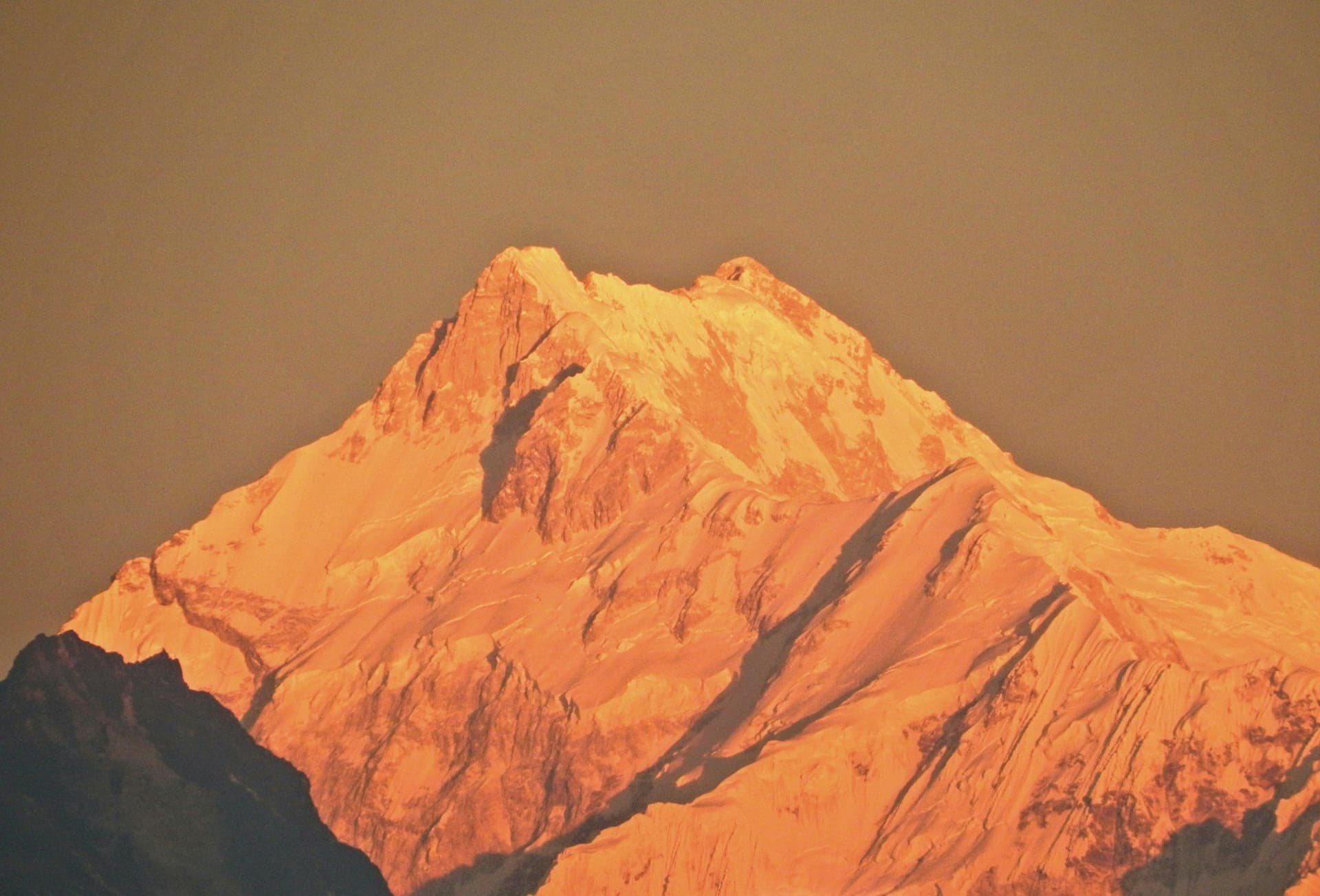
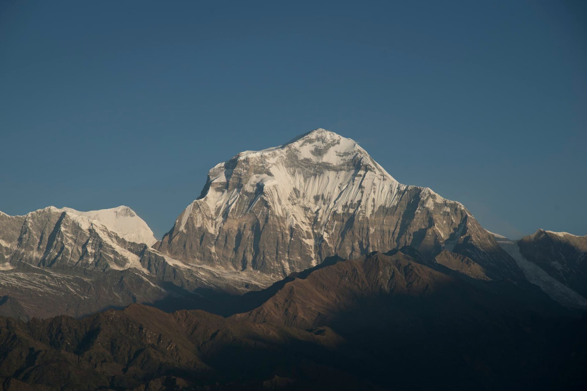
Dhaulagiri means "white mountain". At 8,167 metres it is the seventh-highest on earth and, for thirty years after its survey in 1808, was believed to be the highest anywhere. It stands directly opposite Annapurna I across the Kali Gandaki, and the seven vertical kilometres between the two make that gorge the deepest in the world.
The circuit round it is the hardest thing on Trek Heaven that does not involve climbing.
Why it is different
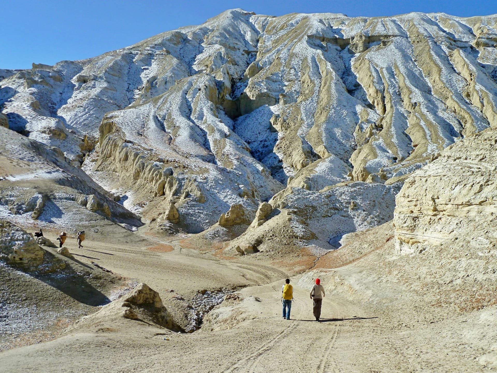
Nepal's famous treks are teahouse treks: you walk between villages and sleep in lodges. There are no villages on the middle of this route. Above Boghara there is nothing permanent until Yak Kharka, nine days later on the far side of two passes.
So everything is carried — tents, food, fuel, a cook, a crew. That is why it costs what it costs, and why the group you walk with is larger than you are.
The route
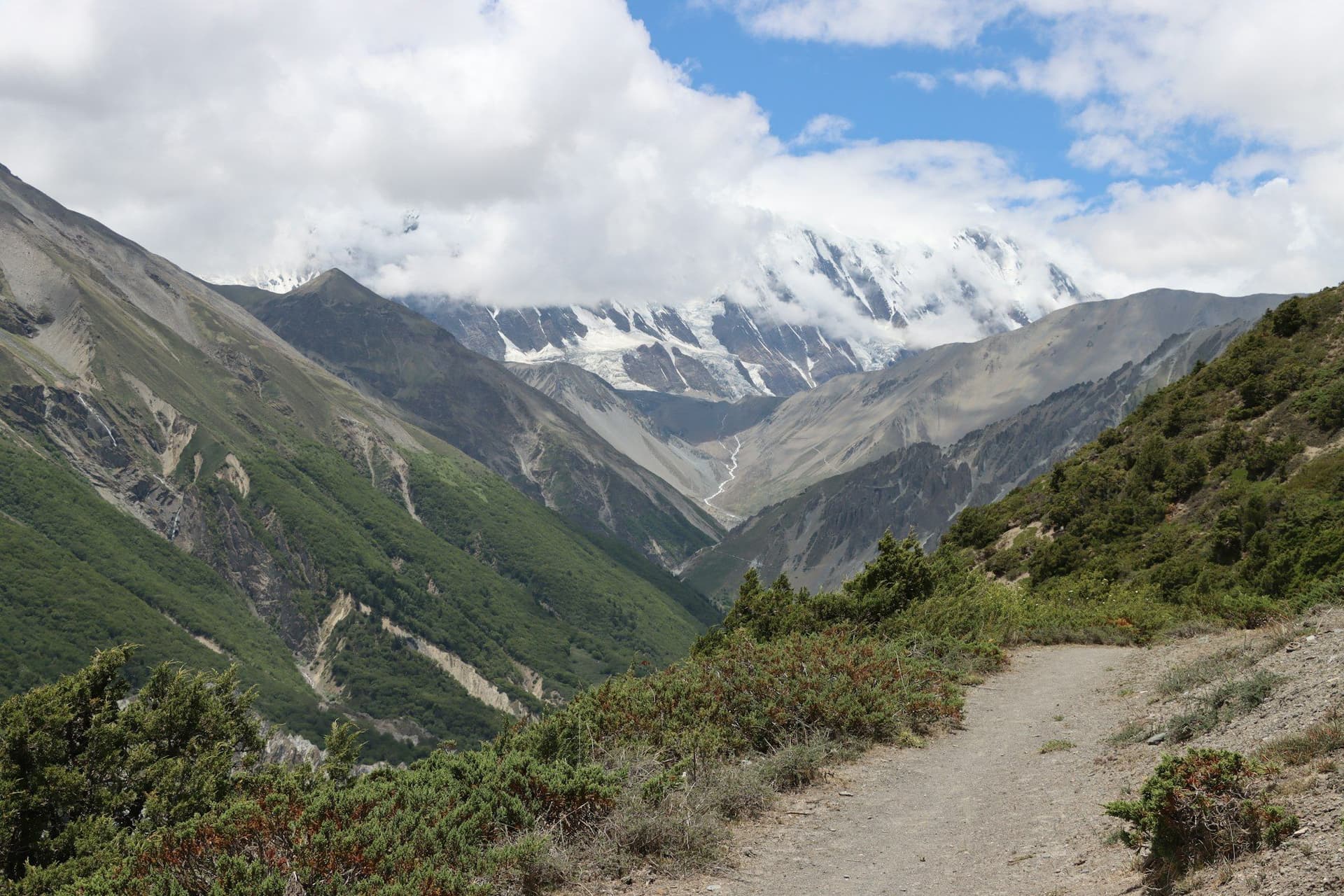
Up the Myagdi Khola through Magar villages and then birch and bamboo gorge to Italian Base Camp at 3,660 m. Onto the Chhonbardan Glacier — moraine, then ice, then Dhaulagiri Base Camp at 4,740 m directly under the north face.
French Pass, 5,360 m, is the crux: a pre-dawn start, usually on snow, into Hidden Valley — a flat uninhabited basin at 5,050 m where you camp one very cold night.
Then Dhampus Pass and a 1,580-metre descent to Yak Kharka, and down to Marpha in the Kali Gandaki, where there are beds, hot water and apple brandy.
What it asks
Crampons and a rope on the glacier. Cold camps at 5,000 m. Nine days with no resupply and no quick way out. Two passes that close for snow.
It is not technical, but it is a long way from a lodge, and it should not be a first Himalayan trek.
Best season
Late April to mid May and October, and that is the whole list. French Pass holds spring snow late and takes autumn snow early, so the windows are narrow at both ends. Never in winter.
Day by day
The 15 days itinerary
Distances, walking times, altitudes and accommodation for every stage — stored as structured data, not written into the prose.
- Day 1
Pokhara to Darbang
Pokhara (822 m) → Beni → Darbang (1,110 m)
- Walking
- 5 hours by road
- Altitude
- 822 m → 1,110 m
- Sleep
- Guesthouse, Darbang
- Meals
- Lunch, dinner
- Day 2
Darbang to Dharapani
Darbang (1,110 m) → Dharapani (1,560 m)
- Distance
- 12 km
- Walking
- 6 hours
- Altitude
- 1,110 m → 1,560 m
- Elevation
- +600 m
- Sleep
- Camp, Dharapani
- Meals
- Breakfast, lunch, dinner
- Day 3
Dharapani to Muri
Dharapani (1,560 m) → Muri (1,850 m)
- Distance
- 14 km
- Walking
- 6 hours
- Altitude
- 1,560 m → 1,850 m
- Elevation
- +700 m / −400 m
- Sleep
- Camp, Muri
- Meals
- Breakfast, lunch, dinner
- Magar villages
- First Dhaulagiri view
- Day 4
Muri to Boghara
Muri (1,850 m) → Boghara (2,080 m)
- Distance
- 13 km
- Walking
- 7 hours
- Altitude
- 1,850 m → 2,080 m
- Elevation
- +800 m / −570 m
- Sleep
- Camp, Boghara
- Meals
- Breakfast, lunch, dinner
The last permanently inhabited village. Everything above this point is carried.
- Day 5
Boghara to Dobang
Boghara (2,080 m) → Dobang (2,520 m)
- Distance
- 11 km
- Walking
- 6 hours
- Altitude
- 2,080 m → 2,520 m
- Elevation
- +600 m
- Sleep
- Camp, Dobang
- Meals
- Breakfast, lunch, dinner
- Day 6
Dobang to Choriban Khola
Dobang (2,520 m) → Choriban Khola (3,110 m)
- Distance
- 9 km
- Walking
- 6 hours
- Altitude
- 2,520 m → 3,110 m
- Elevation
- +590 m
- Sleep
- Camp, Choriban Khola
- Meals
- Breakfast, lunch, dinner
- Bamboo and birch forest
- Myagdi Khola gorge
- Day 7
Choriban Khola to Italian Base Camp
Choriban Khola (3,110 m) → Italian Base Camp (3,660 m)
- Distance
- 8 km
- Walking
- 5 hours
- Altitude
- 3,110 m → 3,660 m
- Elevation
- +550 m
- Sleep
- Camp, Italian Base Camp
- Meals
- Breakfast, lunch, dinner
- Dhaulagiri south face
- Day 8
Acclimatisation at Italian Base Camp
Italian Base Camp (3,660 m)
- Walking
- 4 hours
- Altitude
- 3,660 m → 3,660 m
- Sleep
- Camp, Italian Base Camp
- Meals
- Breakfast, lunch, dinner
A necessary rest day, with a walk high toward the glacier and a return to sleep low. The next four days are all above 4,000 m.
- Day 9
Italian Base Camp to Glacier Camp
Italian Base Camp (3,660 m) → Glacier Camp (4,210 m)
- Distance
- 7 km
- Walking
- 6 hours
- Altitude
- 3,660 m → 4,210 m
- Elevation
- +550 m
- Sleep
- Camp, Glacier Camp
- Meals
- Breakfast, lunch, dinner
Onto the Chhonbardan Glacier. Loose moraine and, depending on the season, the first crampon section.
- Day 10
Glacier Camp to Dhaulagiri Base Camp
Glacier Camp (4,210 m) → Dhaulagiri Base Camp (4,740 m)
- Distance
- 8 km
- Walking
- 6 hours
- Altitude
- 4,210 m → 4,740 m
- Elevation
- +530 m
- Sleep
- Camp, Dhaulagiri Base Camp
- Meals
- Breakfast, lunch, dinner
- Dhaulagiri north face
- Tukuche Peak
- The icefall
- Day 11
Rest day at base camp
Dhaulagiri Base Camp (4,740 m)
- Walking
- 3 hours
- Altitude
- 4,740 m → 4,740 m
- Sleep
- Camp, Dhaulagiri Base Camp
- Meals
- Breakfast, lunch, dinner
Acclimatisation and a weather day in hand. French Pass is the crux and should not be attempted on a marginal forecast.
- Day 12
Base Camp over French Pass to Hidden Valley
Dhaulagiri Base Camp (4,740 m) → French Pass (5,360 m) → Hidden Valley (5,050 m)
- Distance
- 10 km
- Walking
- 8 hours
- Altitude
- 4,740 m → 5,050 m
- Elevation
- +620 m / −310 m
- Sleep
- Camp, Hidden Valley
- Meals
- Breakfast, lunch, dinner
The crux day. A pre-dawn start, snow underfoot most seasons, and a camp at 5,050 m in a valley with no inhabitants and no shelter. It is very cold.
- French Pass at 5
- 360 m
- Hidden Valley
- Sita Chuchura and Tashi Kang
- Day 13
Hidden Valley over Dhampus Pass to Yak Kharka
Hidden Valley (5,050 m) → Dhampus Pass (5,258 m) → Yak Kharka (3,680 m)
- Distance
- 14 km
- Walking
- 8 hours
- Altitude
- 5,050 m → 3,680 m
- Elevation
- +210 m / −1580 m
- Sleep
- Camp, Yak Kharka
- Meals
- Breakfast, lunch, dinner
A short climb and then a very long descent — 1,580 metres, much of it on loose scree. Hard on the knees and the longest drop of the trek.
- Dhampus Pass
- The Kali Gandaki opening below
- Day 14
Yak Kharka to Marpha
Yak Kharka (3,680 m) → Marpha (2,670 m)
- Distance
- 10 km
- Walking
- 5 hours
- Altitude
- 3,680 m → 2,670 m
- Elevation
- −1010 m
- Sleep
- Guesthouse, Marpha
- Meals
- Breakfast, lunch, dinner
Back among people, on a road, in a village with beds and hot showers. The contrast after nine days of tents is considerable.
- Marpha's whitewashed lanes
- Apple orchards and brandy
- Day 15
Marpha to Jomsom, fly or drive to Pokhara
Marpha (2,670 m) → Jomsom (2,720 m) → Pokhara (822 m)
- Distance
- 7 km
- Walking
- 2 hours walking, then flight or jeep
- Altitude
- 2,670 m → 822 m
- Sleep
- Hotel, Pokhara
- Meals
- Breakfast
Route map
Where the trail goes
Route line, start and end points, and every overnight stop. Locations are shared entities — the same record powers the destination and itinerary pages.
Frequently asked questions
Why is there no teahouse version?
Do you need technical skills?
When can it be walked?
What is Hidden Valley like?
Is there a bail-out?
What is the Dhaulagiri Circuit trek?
About the author
Tom Eriksen
Gear editor & photographer
Tom tests trekking equipment the only way that produces honest answers: by carrying it for weeks at a time above 4,000 metres. He shoots most of the photography on this site and writes the gear reviews, comparison tables and packing lists.
Writes about: Trekking gear · Photography · Packing and weight