Overview
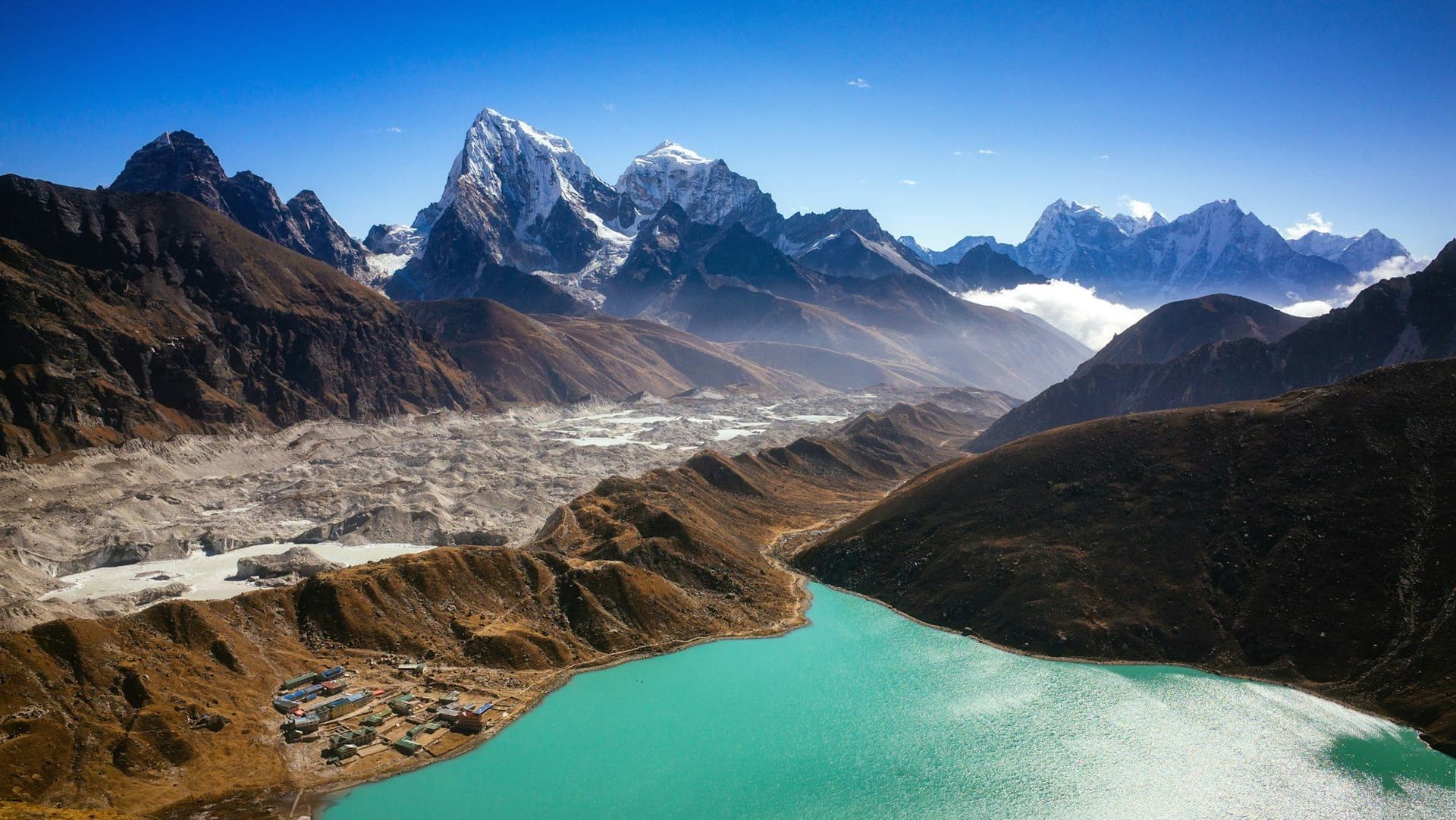
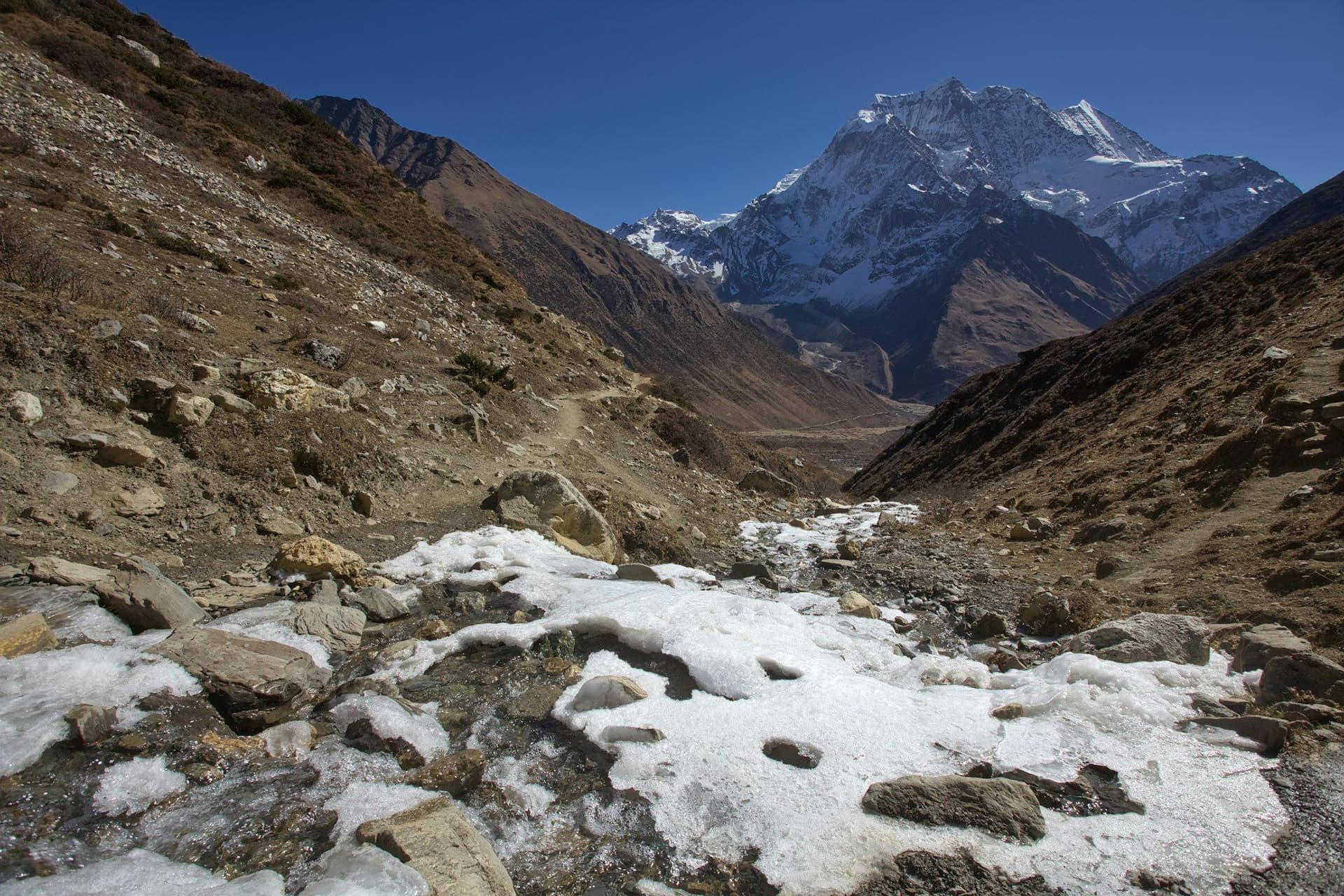
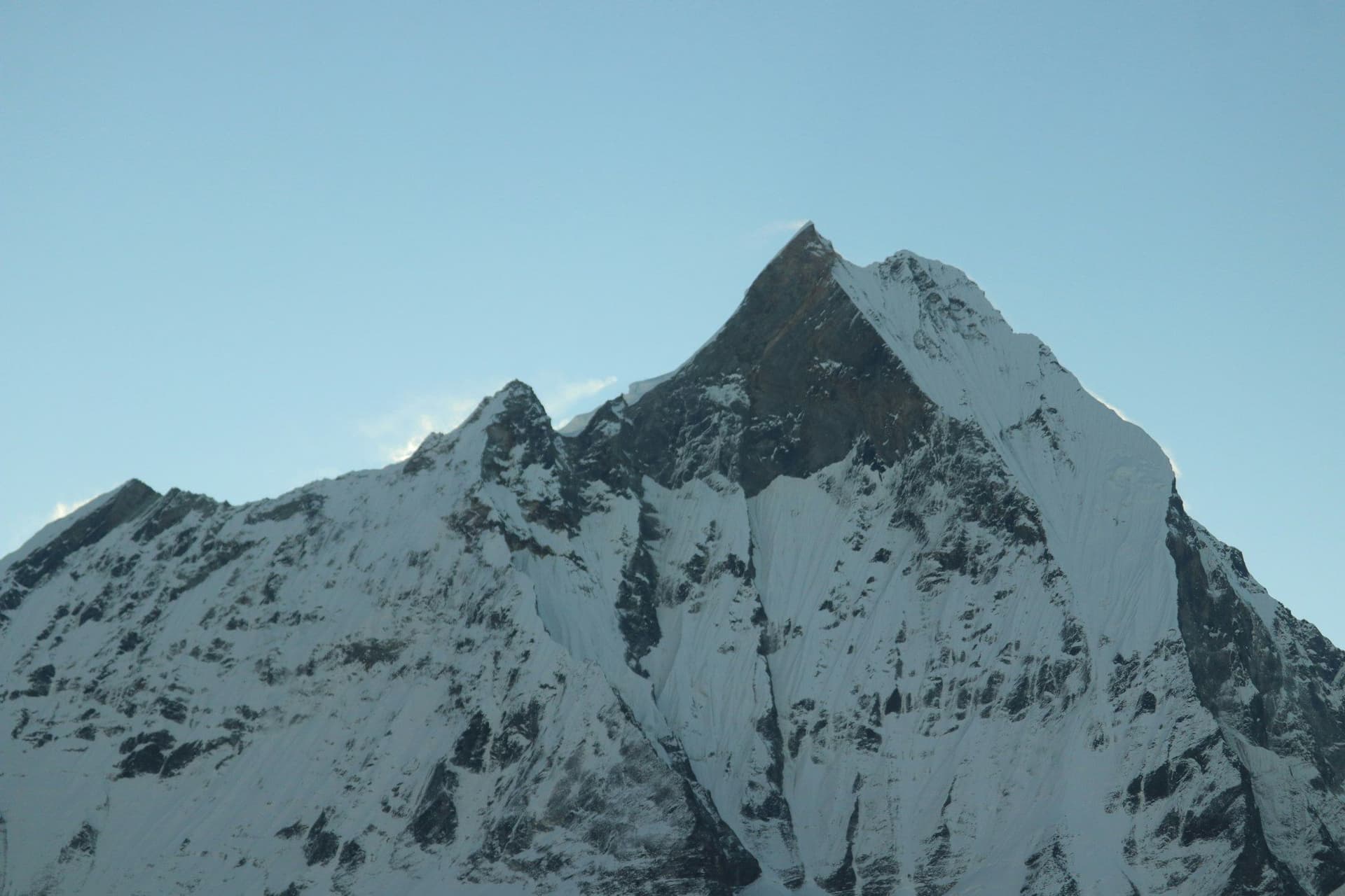
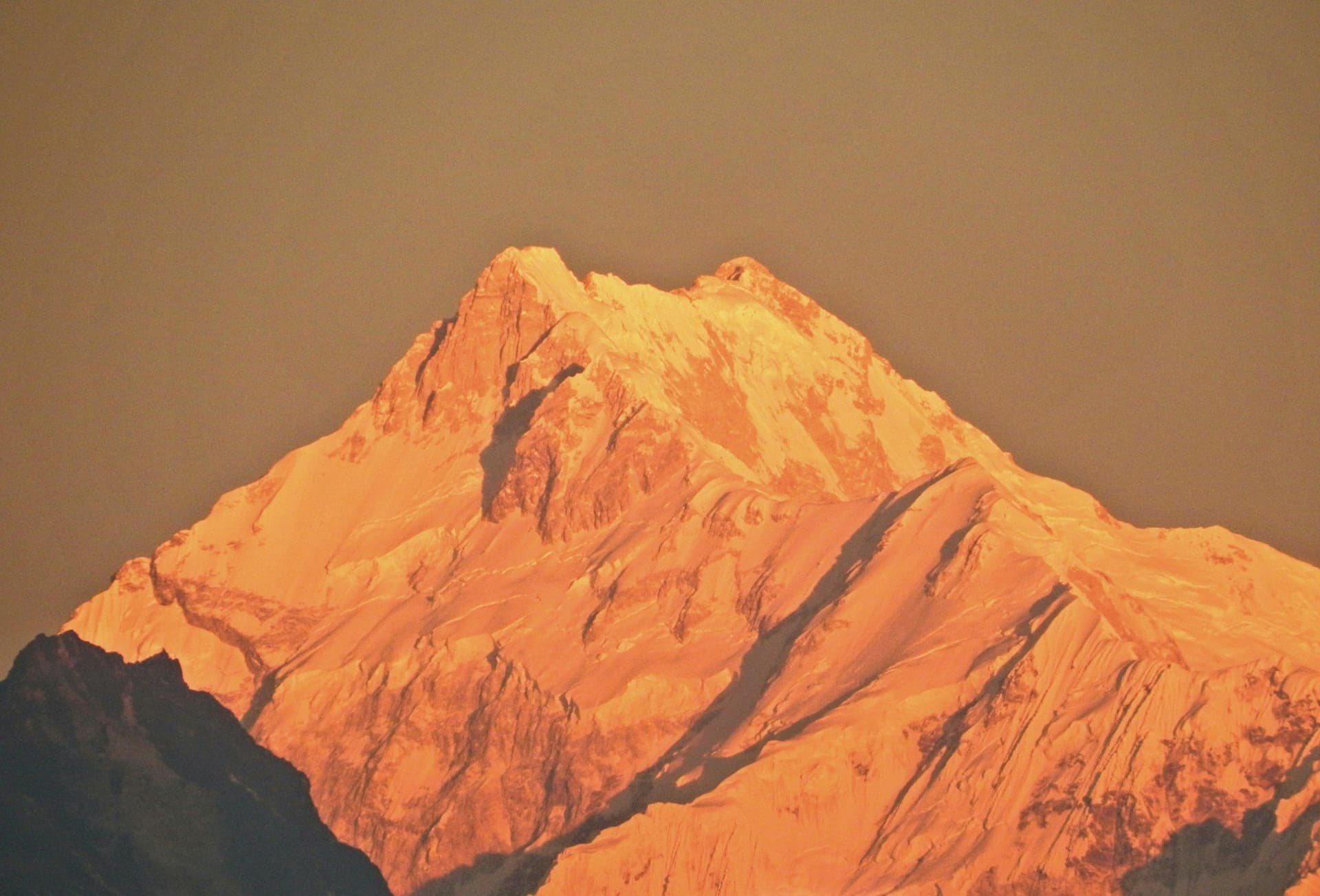
Kanchenjunga is the third-highest mountain on earth at 8,586 metres, sitting on the Nepal–Sikkim border in the far east of the country. Getting to the trailhead takes two days from Kathmandu. Walking the circuit takes three weeks. In return you get a Himalayan trek that still looks the way the Khumbu did forty years ago.
Around a few hundred trekkers a year walk it. Everest Base Camp takes thirty thousand.
The two base camps
The massif has a base camp on each side and the full circuit visits both.
Pangpema, the north base camp at 5,143 m, is the classic: a flat shelf above the Kanchenjunga Glacier with the entire north face rising in front of it. The approach up the Ghunsa valley passes beneath Jannu's north wall, which is arguably the more startling mountain of the two.
Oktang, the south base camp at about 4,730 m, is reached up the Yalung Glacier from Ramche and faces the south-west face and the long summit ridge.
Between them lies the Sele La — not one pass but four, crossed in a single nine-hour day between 4,480 m and 4,660 m. It is the crux of the circuit and the part most likely to be closed by snow.
Getting there
Fly Kathmandu to Bhadrapur in the eastern Terai, then eight to ten hours by road north through the Ilam tea hills to Taplejung. Suketar airstrip above Taplejung exists but operates unreliably; do not build an itinerary around it.
Budget a spare day at each end. The Bhadrapur flight and the road are both weather-dependent.
Permits and rules
Restricted area, and the rules are enforced. The permit is issued only through a registered trekking agency, requires a licensed guide throughout, and requires a minimum of two trekkers — a rule that has not been relaxed here the way it has elsewhere. A separate Kanchenjunga Conservation Area permit is needed on top.
Practicalities
Lodges are simple and thin on the ground. Lhonak, Sele Le and Ramche have one or two huts apiece, so a large group ahead of you is a real problem in October. There is no reliable charging above Ghunsa, no ATM after Taplejung, and no helicopter evacuation guarantee — insurance covering evacuation from 5,200 m in a remote region is essential rather than advisable.
Bring a sleeping bag good to about -15°C. The high camps are cold and unheated.
Best season
October and November for the most stable weather and the clearest views, and April and May for rhododendron through the lower valleys, at the cost of more haze up high. Spring carries a higher chance that the Sele La is still under snow. The monsoon closes the whole thing — the lower trail is leech country and the road to Taplejung washes out.
Day by day
The 21 days itinerary
Distances, walking times, altitudes and accommodation for every stage — stored as structured data, not written into the prose.
- Day 1
Kathmandu to Bhadrapur, drive to Taplejung
Kathmandu (1,400 m) → Bhadrapur (91 m) → Taplejung (1,820 m)
- Walking
- 45 min flight, 8–10 hours by road
- Altitude
- 1,400 m → 1,820 m
- Sleep
- Guesthouse, Taplejung
- Meals
- Lunch, dinner
A short flight to the eastern Terai and then a very long day of mountain road north. Many itineraries break the drive at Ilam, in the tea country.
- Day 2
Taplejung to Chirwa
Taplejung (1,820 m) → Mitlung → Chirwa (1,270 m)
- Distance
- 20 km
- Walking
- 6 hours
- Altitude
- 1,820 m → 1,270 m
- Elevation
- −700 m
- Sleep
- Teahouse, Chirwa
- Meals
- Breakfast, lunch, dinner
- Tamur river valley
- Limbu villages
- Cardamom plantations
- Day 3
Chirwa to Sekathum
Chirwa (1,270 m) → Tapethok → Sekathum (1,660 m)
- Distance
- 15 km
- Walking
- 6 hours
- Altitude
- 1,270 m → 1,660 m
- Elevation
- +500 m
- Sleep
- Teahouse, Sekathum
- Meals
- Breakfast, lunch, dinner
Permits are checked at Tapethok. At Sekathum the valley splits — north for Pangpema, east and south for the Yalung side.
- Day 4
Sekathum to Amjilosa
Sekathum (1,660 m) → Amjilosa (2,510 m)
- Distance
- 11 km
- Walking
- 7 hours
- Altitude
- 1,660 m → 2,510 m
- Elevation
- +900 m
- Sleep
- Teahouse, Amjilosa
- Meals
- Breakfast, lunch, dinner
A hard, steep day on an exposed trail above the Ghunsa Khola, with several suspension bridges and a long final climb.
- Day 5
Amjilosa to Gyabla
Amjilosa (2,510 m) → Gyabla (2,730 m)
- Distance
- 11 km
- Walking
- 5 hours
- Altitude
- 2,510 m → 2,730 m
- Elevation
- +400 m
- Sleep
- Teahouse, Gyabla
- Meals
- Breakfast, lunch, dinner
- Waterfalls
- Bamboo and fir forest
- Day 6
Gyabla to Ghunsa
Gyabla (2,730 m) → Phale → Ghunsa (3,595 m)
- Distance
- 12 km
- Walking
- 5 hours
- Altitude
- 2,730 m → 3,595 m
- Elevation
- +870 m
- Sleep
- Teahouse, Ghunsa
- Meals
- Breakfast, lunch, dinner
Ghunsa is the largest settlement on the northern side and the hub of the trek — a Tibetan-speaking village with its own micro-hydro scheme.
- Phale Tibetan refugee settlement
- Ghunsa gompa
- Micro-hydro village
- Day 7
Ghunsa — acclimatisation day
Ghunsa (3,595 m), day walk toward Yamatari
- Walking
- 4 hours
- Altitude
- 3,595 m → 3,595 m
- Sleep
- Teahouse, Ghunsa
- Meals
- Breakfast, lunch, dinner
A necessary rest day. Walk high toward the Yamatari glacier viewpoint and sleep back in the village.
- Day 8
Ghunsa to Kambachen
Ghunsa (3,595 m) → Rampuk Kharka → Kambachen (4,050 m)
- Distance
- 11 km
- Walking
- 6 hours
- Altitude
- 3,595 m → 4,050 m
- Elevation
- +460 m
- Sleep
- Teahouse, Kambachen
- Meals
- Breakfast, lunch, dinner
The treeline is passed and Jannu's north face — one of the most formidable walls in the Himalaya — comes into view. One long, loose landslide traverse before Kambachen requires care.
- Jannu (Kumbhakarna) north face
- Landslide traverse
- Day 9
Kambachen to Lhonak
Kambachen (4,050 m) → Ramtang → Lhonak (4,780 m)
- Distance
- 10 km
- Walking
- 6 hours
- Altitude
- 4,050 m → 4,780 m
- Elevation
- +730 m
- Sleep
- Teahouse, Lhonak
- Meals
- Breakfast, lunch, dinner
Onto the glacier moraine. Lhonak is a handful of huts on a dry lake bed — cold, high and exposed.
- Ramtang monastery ruins
- Kanchenjunga Glacier moraine
- Wolf's Fang
- Day 10
Lhonak to Pangpema and back
Lhonak (4,780 m) → Pangpema / North Base Camp (5,143 m) → Lhonak
- Distance
- 14 km
- Walking
- 7 hours
- Altitude
- 4,780 m → 4,780 m
- Elevation
- +370 m / −370 m
- Sleep
- Teahouse, Lhonak
- Meals
- Breakfast, lunch, dinner
The northern climax. Pangpema at 5,143 m sits directly beneath the north face, with the whole 8,586-metre wall rising in front of you across the glacier. Many walk another hour above the camp for the wider view.
- Kanchenjunga north face
- Pangpema
- Wedge Peak
- Twins and Nepal Peak
- Day 11
Lhonak to Ghunsa
Lhonak (4,780 m) → Kambachen → Ghunsa (3,595 m)
- Distance
- 21 km
- Walking
- 8 hours
- Altitude
- 4,780 m → 3,595 m
- Elevation
- −1190 m
- Sleep
- Teahouse, Ghunsa
- Meals
- Breakfast, lunch, dinner
- Day 12
Ghunsa to Sele La Camp
Ghunsa (3,595 m) → Sele La Camp (4,290 m)
- Distance
- 10 km
- Walking
- 6 hours
- Altitude
- 3,595 m → 4,290 m
- Elevation
- +700 m
- Sleep
- Basic lodge, Sele Le
- Meals
- Breakfast, lunch, dinner
A steep climb through rhododendron and juniper to a bleak camp below the pass line. Two huts, and often full.
- Day 13
Sele La to Tseram over four passes
Sele La Camp (4,290 m) → Sinion La (4,660 m) → Mirgin La (4,480 m) → Sinelapche La (4,646 m) → Tseram (3,870 m)
- Distance
- 14 km
- Walking
- 9 hours
- Altitude
- 4,290 m → 3,870 m
- Elevation
- +800 m / −1220 m
- Sleep
- Teahouse, Tseram
- Meals
- Breakfast, lunch, dinner
The crux of the circuit and the longest day on it. A chain of four passes links the Ghunsa and Yalung valleys, with a big drop at the end. In snow this day can be impassable — the ridge is the one part of the trek where the weather can genuinely stop you.
- Four passes in one day
- Jannu from the south
- Makalu and Everest on a clear day
- Day 14
Tseram to Ramche
Tseram (3,870 m) → Yalung Glacier → Ramche (4,580 m)
- Distance
- 9 km
- Walking
- 5 hours
- Altitude
- 3,870 m → 4,580 m
- Elevation
- +710 m
- Sleep
- Teahouse, Ramche
- Meals
- Breakfast, lunch, dinner
- Yalung Glacier
- Rathong and Kabru
- Blue sheep
- Day 15
Ramche to Oktang and back to Tseram
Ramche (4,580 m) → Oktang / South Base Camp (4,730 m) → Tseram (3,870 m)
- Distance
- 16 km
- Walking
- 7 hours
- Altitude
- 4,580 m → 3,870 m
- Elevation
- +200 m / −910 m
- Sleep
- Teahouse, Tseram
- Meals
- Breakfast, lunch, dinner
The southern climax: a prayer-flagged chorten at Oktang looking straight up the Yalung Glacier at the south-west face and the summit ridge.
- Oktang chorten
- Kanchenjunga south-west face
- Yalung Glacier head
- Day 16
Tseram to Torontan
Tseram (3,870 m) → Lasiya Bhanjyang → Torontan (2,995 m)
- Distance
- 16 km
- Walking
- 7 hours
- Altitude
- 3,870 m → 2,995 m
- Elevation
- −900 m
- Sleep
- Teahouse, Torontan
- Meals
- Breakfast, lunch, dinner
- Day 17
Torontan to Yamphudin
Torontan (2,995 m) → Deurali → Yamphudin (2,080 m)
- Distance
- 18 km
- Walking
- 7 hours
- Altitude
- 2,995 m → 2,080 m
- Elevation
- +400 m / −1300 m
- Sleep
- Teahouse, Yamphudin
- Meals
- Breakfast, lunch, dinner
Back into farmland and mixed Limbu, Rai and Sherpa villages. Yamphudin is the first place with a road connection on the southern side.
- Day 18
Yamphudin to Khebang
Yamphudin (2,080 m) → Mamankhe → Khebang (1,910 m)
- Distance
- 18 km
- Walking
- 7 hours
- Altitude
- 2,080 m → 1,910 m
- Elevation
- +500 m / −670 m
- Sleep
- Teahouse, Khebang
- Meals
- Breakfast, lunch, dinner
- Day 19
Khebang to Taplejung
Khebang (1,910 m) → Happu Khola → Taplejung (1,820 m)
- Distance
- 14 km
- Walking
- 4 hours walking, 2 hours by jeep
- Altitude
- 1,910 m → 1,820 m
- Sleep
- Guesthouse, Taplejung
- Meals
- Breakfast, lunch, dinner
- Day 20
Taplejung to Bhadrapur
Taplejung (1,820 m) → Ilam → Bhadrapur (91 m)
- Walking
- 8–10 hours by road
- Altitude
- 1,820 m → 91 m
- Sleep
- Hotel, Bhadrapur
- Meals
- Breakfast, lunch, dinner
- Ilam tea gardens
- Day 21
Bhadrapur to Kathmandu
Bhadrapur (91 m) → Kathmandu (1,400 m)
- Walking
- 45 minutes by air
- Altitude
- 91 m → 1,400 m
- Sleep
- Hotel, Kathmandu
- Meals
- Breakfast
Route map
Where the trail goes
Route line, start and end points, and every overnight stop. Locations are shared entities — the same record powers the destination and itinerary pages.
Frequently asked questions
How hard is the Kanchenjunga trek?
Do you have to visit both base camps?
What permits do you need?
What are the lodges like?
Can you see Everest from the trek?
What is the Kanchenjunga Base Camp trek?
Can You Trek Kanchenjunga or Manaslu Without a Guide in 2025?
About the author
Maya Thapa
Senior trekking writer
Maya has walked more than 4,000 kilometres of Nepal's trail network, from the teahouse highways of the Khumbu to the restricted valleys along the Tibetan border. She writes the route guides and day-by-day itineraries, and returns to most trails every second season to re-check lodge availability, water points and trail reroutes after monsoon damage.
Writes about: Nepal trekking · High-altitude routes · Teahouse logistics