Overview
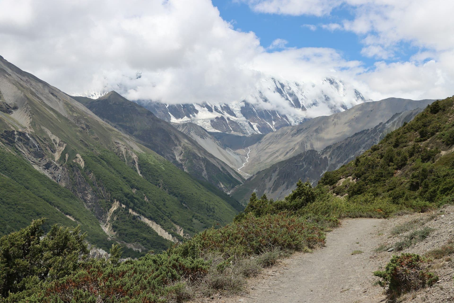
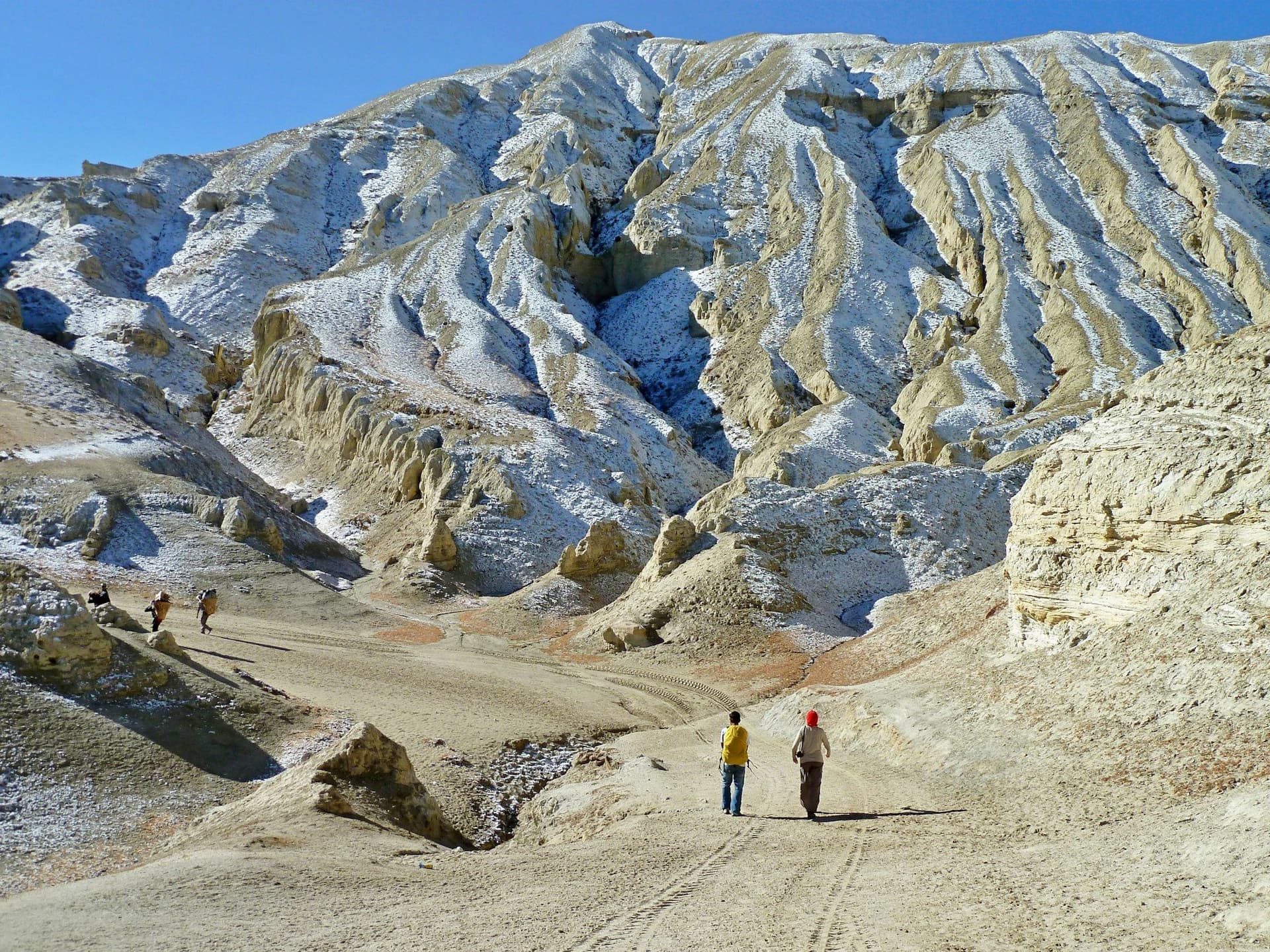
North of Kagbeni the green stops. The Kali Gandaki has cut its way between Annapurna and Dhaulagiri, and everything beyond is in their rain shadow — a high, dry, wind-scoured plateau of red and grey cliff that belongs geographically to Tibet.
This was the Kingdom of Lo, independent from the fifteenth century, absorbed into Nepal in the eighteenth but keeping its own king until 2008. It was closed to foreigners until 1992 and remains restricted, at USD 500 a head for ten days.
Route
The classic itinerary walks north from Kagbeni through Chele, Syangboche, Ghami and Tsarang — crossing a series of passes between 3,600 m and 4,000 m, each one opening onto another eroded, empty valley.
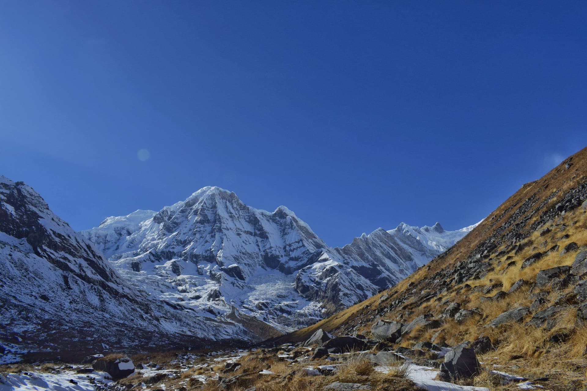
Lo Manthang appears all at once from the Lo La: a walled white town on a bare plain, four storeys of monastery above the houses, with Nilgiri and the Annapurnas on the southern horizon. Inside the walls are Jampa Lhakhang (1448), Thubchen and Chodey, and the former royal palace.
The return leg turns east through Yara, Tange and over the Pa La at 4,230 m — the hardest day, and the one that keeps you off the jeep road.
Cave country
Mustang's cliffs are honeycombed with man-made caves, some 2,500 years old, many of them dozens of metres up sheer rock with no evident means of access. The Jhong caves at Chhoser are the accessible showpiece — five storeys, connected by internal ladders. Luri Gompa, on the eastern return, is a cave monastery with a painted chorten inside the rock.
Practicalities
Lodges are simple village guesthouses; Lo Manthang has a few better ones. Water is scarce on the passes and there are long unpopulated stretches — the Tange to Tetang day has no settlement at all for nine hours.
The Kali Gandaki wind is a daily fact. It rises around 10am and blows hard up the valley all afternoon, which is why everyone starts at dawn and why Jomsom flights are morning-only.
Best season
Unusually wide: April to early November. May brings the Tiji festival, June to August is dry here when the rest of Nepal is not, and October gives the clearest air. Winter is cold enough that much of the population migrates south.
Day by day
The 13 days itinerary
Distances, walking times, altitudes and accommodation for every stage — stored as structured data, not written into the prose.
- Day 1
Pokhara to Jomsom, walk to Kagbeni
Pokhara (822 m) → Jomsom (2,720 m) → Kagbeni (2,810 m)
- Distance
- 9 km
- Walking
- 3 hours
- Altitude
- 2,720 m → 2,810 m
- Elevation
- +90 m
- Sleep
- Guesthouse, Kagbeni
- Meals
- Lunch, dinner
An early flight into Jomsom before the valley wind gets up — it blows hard from mid-morning, every day. Kagbeni is the last open village and the Upper Mustang checkpoint.
- Kali Gandaki valley
- Kagbeni old town
- Red gompa
- Day 2
Kagbeni to Chele
Kagbeni (2,810 m) → Tangbe → Chhusang → Chele (3,050 m)
- Distance
- 14 km
- Walking
- 6 hours
- Altitude
- 2,810 m → 3,050 m
- Elevation
- +400 m
- Sleep
- Guesthouse, Chele
- Meals
- Breakfast, lunch, dinner
Permits are stamped at Kagbeni and the landscape changes immediately — green stops, and the walls of the valley turn red and ochre.
- Restricted area checkpoint
- Red cliffs at Chhusang
- Kali Gandaki riverbed
- Day 3
Chele to Syangboche
Chele (3,050 m) → Taklam La (3,624 m) → Dajori La → Syangboche (3,800 m)
- Distance
- 15 km
- Walking
- 7 hours
- Altitude
- 3,050 m → 3,800 m
- Elevation
- +900 m / −150 m
- Sleep
- Guesthouse, Syangboche
- Meals
- Breakfast, lunch, dinner
- Taklam La
- Nilgiri and Tilicho views back south
- Day 4
Syangboche to Ghami
Syangboche (3,800 m) → Yamda La (3,850 m) → Nyi La (4,010 m) → Ghami (3,520 m)
- Distance
- 16 km
- Walking
- 6 hours
- Altitude
- 3,800 m → 3,520 m
- Elevation
- +400 m / −680 m
- Sleep
- Guesthouse, Ghami
- Meals
- Breakfast, lunch, dinner
Below Ghami is the longest mani wall in Nepal — several hundred metres of carved stone along the hillside.
- Nyi La
- Ghami mani wall
- Whitewashed village
- Day 5
Ghami to Tsarang
Ghami (3,520 m) → Ghami La (3,765 m) → Tsarang (3,560 m)
- Distance
- 12 km
- Walking
- 5 hours
- Altitude
- 3,520 m → 3,560 m
- Elevation
- +350 m / −310 m
- Sleep
- Guesthouse, Tsarang
- Meals
- Breakfast, lunch, dinner
- Tsarang Gompa
- Old royal palace
- Red monastery walls
- Day 6
Tsarang to Lo Manthang
Tsarang (3,560 m) → Lo La (3,950 m) → Lo Manthang (3,840 m)
- Distance
- 14 km
- Walking
- 6 hours
- Altitude
- 3,560 m → 3,840 m
- Elevation
- +480 m / −190 m
- Sleep
- Guesthouse, Lo Manthang
- Meals
- Breakfast, lunch, dinner
From the Lo La the whole walled city appears below at once — a white rectangle on an empty brown plain, with the Himalaya behind it.
- First view of Lo Manthang from Lo La
- City walls
- Nilgiri and Annapurna skyline
- Day 7
Lo Manthang — exploring the city
Lo Manthang (3,840 m)
- Walking
- 4 hours
- Altitude
- 3,840 m → 3,840 m
- Sleep
- Guesthouse, Lo Manthang
- Meals
- Breakfast, lunch, dinner
Three great monasteries inside the walls, the oldest — Jampa Lhakhang — dating to 1448, with restored fifteenth-century mandala murals.
- Jampa Lhakhang
- Thubchen Gompa
- Chodey Gompa
- The royal palace
- Day 8
Day trip to Chhoser caves
Lo Manthang → Chhoser (3,900 m) → Lo Manthang
- Distance
- 14 km
- Walking
- 5 hours
- Altitude
- 3,840 m → 3,840 m
- Elevation
- +300 m / −300 m
- Sleep
- Guesthouse, Lo Manthang
- Meals
- Breakfast, lunch, dinner
The Jhong caves are a five-storey warren cut into a cliff face, thought to be around 2,500 years old and reached by internal ladders.
- Jhong sky caves
- Nyphu cave monastery
- Tibet border viewpoint
- Day 9
Lo Manthang to Yara
Lo Manthang (3,840 m) → Dhi → Yara (3,650 m)
- Distance
- 20 km
- Walking
- 7 hours
- Altitude
- 3,840 m → 3,650 m
- Elevation
- +400 m / −590 m
- Sleep
- Guesthouse, Yara
- Meals
- Breakfast, lunch, dinner
The eastern return route, well off the jeep road and through emptier country than the way north.
- Day 10
Yara to Tange
Yara (3,650 m) → Luri Gompa → Tange (3,240 m)
- Distance
- 18 km
- Walking
- 7 hours
- Altitude
- 3,650 m → 3,240 m
- Elevation
- +450 m / −860 m
- Sleep
- Guesthouse, Tange
- Meals
- Breakfast, lunch, dinner
- Luri Gompa cave monastery
- Chorten murals
- Day 11
Tange to Tetang
Tange (3,240 m) → Pa La (4,230 m) → Tetang (3,040 m)
- Distance
- 20 km
- Walking
- 9 hours
- Altitude
- 3,240 m → 3,040 m
- Elevation
- +1000 m / −1200 m
- Sleep
- Guesthouse, Tetang
- Meals
- Breakfast, lunch, dinner
The hardest day of the trek: a thousand metres up to the Pa La at 4,230 m with no settlement and no water in between. Start early and carry everything you need.
- Pa La — highest point of the trek
- Long empty ridge crossing
- Day 12
Tetang to Jomsom
Tetang (3,040 m) → Chhusang → Kagbeni → Jomsom (2,720 m)
- Distance
- 18 km
- Walking
- 7 hours
- Altitude
- 3,040 m → 2,720 m
- Elevation
- −420 m
- Sleep
- Hotel, Jomsom
- Meals
- Breakfast, lunch, dinner
- Day 13
Jomsom to Pokhara
Jomsom (2,720 m) → Pokhara (822 m)
- Walking
- 20 minutes by air
- Altitude
- 2,720 m → 822 m
- Sleep
- Hotel, Pokhara
- Meals
- Breakfast
Morning flight only — the Kali Gandaki wind grounds aircraft from late morning. Keep a spare day in Pokhara in case the flight cancels.
Route map
Where the trail goes
Route line, start and end points, and every overnight stop. Locations are shared entities — the same record powers the destination and itinerary pages.
Frequently asked questions
How much does the Upper Mustang permit cost?
Can you trek Upper Mustang during the monsoon?
What is the Tiji festival?
Has the road spoiled the trek?
How high does it go?
What is the Naar to Upper Mustang trek?
About the author
Maya Thapa
Senior trekking writer
Maya has walked more than 4,000 kilometres of Nepal's trail network, from the teahouse highways of the Khumbu to the restricted valleys along the Tibetan border. She writes the route guides and day-by-day itineraries, and returns to most trails every second season to re-check lodge availability, water points and trail reroutes after monsoon damage.
Writes about: Nepal trekking · High-altitude routes · Teahouse logistics