Overview
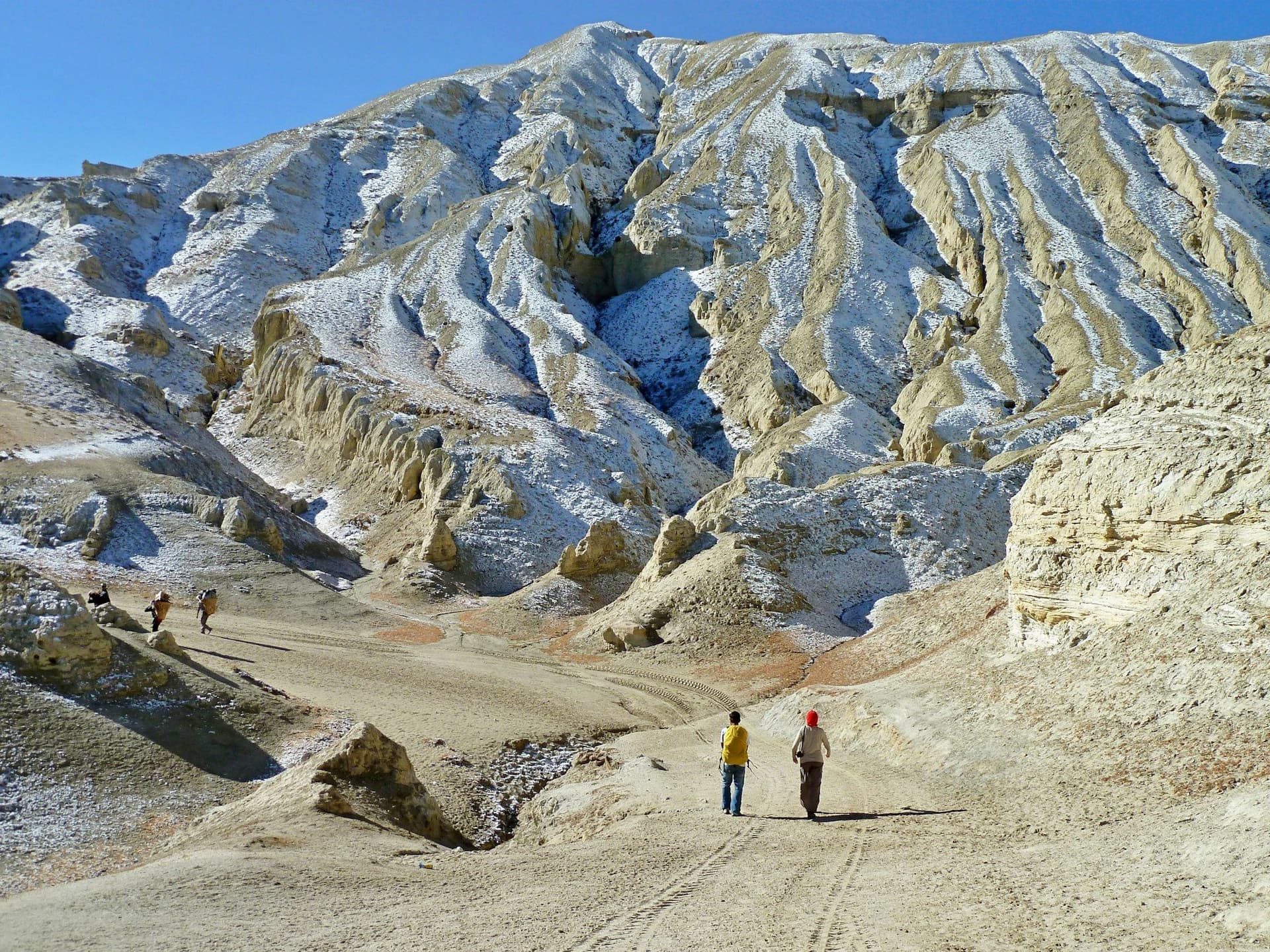
Upper Dolpo is the trans-Himalayan plateau behind Dhaulagiri — Tibetan in culture, desert in climate, and closed to foreigners until 1989. This is the full traverse: in from Juphal, over the Kang La to Shey Gompa, north-east through Saldang, then south over Jeng La to the Tarap valley and out over Numa La and Baga La to Dunai.
Twenty-four days, five passes above 5,000 metres, and roughly 12,000 metres of cumulative ascent.
Phoksundo
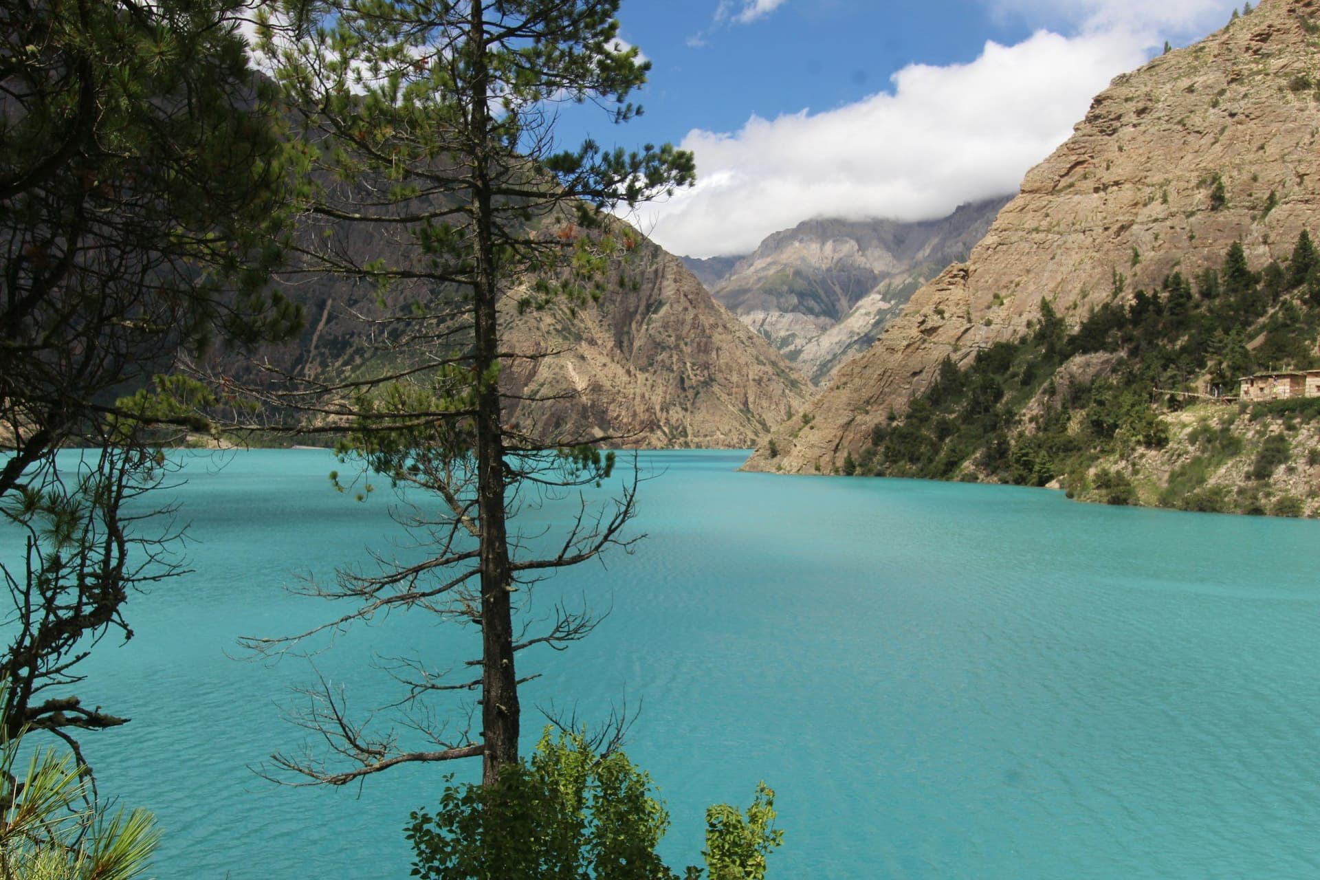
Shey Phoksundo is the deepest lake in Nepal and an implausible turquoise — the colour comes from a lack of aquatic life rather than from minerals. The waterfall below it is the highest in the country.
Above it runs the ledge trail, a path built out from a cliff face that appears in Eric Valli's Himalaya. It looks worse in photographs than it feels underfoot, and it is still no place for real vertigo.
Shey and the Crystal Mountain
Shey Gompa, an eleventh-century red monastery at 4,160 m, sits beneath the quartz-veined Crystal Mountain, which pilgrims from across Dolpo circumambulate. The valleys around it hold both Bon — the pre-Buddhist Tibetan tradition — and Nyingma communities, living alongside each other.
The upside-down season
Dolpo sits in the rain shadow, so the monsoon mostly misses it. May to September is the season here, which makes this one of the few serious Nepali treks that works in summer. Autumn runs into October before the passes take snow.
What it costs
The permit alone is USD 500 for ten days plus USD 50 a day after that — over USD 1,200 for a three-week traverse — and there is no lodge network, so you carry everything with a crew.
Who it is for
People who have already walked the Annapurna Circuit and Everest Base Camp and want the thing that comes after. It is the hardest and the most remote trek on Trek Heaven, and there is no quick way out of the middle of it.
Day by day
The 24 days itinerary
Distances, walking times, altitudes and accommodation for every stage — stored as structured data, not written into the prose.
- Day 1
Kathmandu to Nepalgunj
Kathmandu (1,400 m) → Nepalgunj (150 m)
- Walking
- 1 hour by air
- Altitude
- 1,400 m → 150 m
- Sleep
- Hotel, Nepalgunj
- Meals
- Dinner
- Day 2
Nepalgunj to Juphal, walk to Dunai
Nepalgunj (150 m) → Juphal (2,475 m) → Dunai (2,140 m)
- Distance
- 8 km
- Walking
- 35 min flight, 3 hours walking
- Altitude
- 2,475 m → 2,140 m
- Elevation
- −335 m
- Sleep
- Camp, Dunai
- Meals
- Breakfast, lunch, dinner
- Day 3
Dunai to Ankhe
Dunai (2,140 m) → Ankhe (2,660 m)
- Distance
- 16 km
- Walking
- 6 hours
- Altitude
- 2,140 m → 2,660 m
- Elevation
- +520 m
- Sleep
- Camp, Ankhe
- Meals
- Breakfast, lunch, dinner
- Day 4
Ankhe to Sulighat
Ankhe (2,660 m) → Sulighat (3,100 m)
- Distance
- 14 km
- Walking
- 6 hours
- Altitude
- 2,660 m → 3,100 m
- Elevation
- +600 m / −160 m
- Sleep
- Camp, Sulighat
- Meals
- Breakfast, lunch, dinner
- Day 5
Sulighat to Phoksundo Lake
Sulighat (3,100 m) → Ringmo → Phoksundo (3,611 m)
- Distance
- 12 km
- Walking
- 6 hours
- Altitude
- 3,100 m → 3,611 m
- Elevation
- +511 m
- Sleep
- Camp, Phoksundo
- Meals
- Breakfast, lunch, dinner
- Phoksundo waterfall
- the highest in Nepal
- Ringmo village
- The lake's turquoise
- Day 6
Rest day at Phoksundo
Phoksundo (3,611 m)
- Walking
- 4 hours
- Altitude
- 3,611 m → 3,611 m
- Sleep
- Camp, Phoksundo
- Meals
- Breakfast, lunch, dinner
- Tshowa Bon gompa
- Lakeside walk
- Day 7
Phoksundo to Phoksundo Khola
Phoksundo (3,611 m) → the ledge trail → Phoksundo Khola (3,750 m)
- Distance
- 12 km
- Walking
- 6 hours
- Altitude
- 3,611 m → 3,750 m
- Elevation
- +300 m / −160 m
- Sleep
- Camp, Phoksundo Khola
- Meals
- Breakfast, lunch, dinner
The famous ledge — a path built out from a cliff face above the lake, a few hand-spans wide, that appears in the film *Himalaya*. It is significantly less alarming than it looks, and still not for anyone with real vertigo.
- Day 8
Phoksundo Khola to Snowfields Camp
Phoksundo Khola (3,750 m) → Snowfields Camp (4,700 m)
- Distance
- 14 km
- Walking
- 7 hours
- Altitude
- 3,750 m → 4,700 m
- Elevation
- +950 m
- Sleep
- Camp, Snowfields
- Meals
- Breakfast, lunch, dinner
- Day 9
Over the Kang La to Shey Gompa
Snowfields Camp (4,700 m) → Kang La (5,360 m) → Shey Gompa (4,160 m)
- Distance
- 13 km
- Walking
- 8 hours
- Altitude
- 4,700 m → 4,160 m
- Elevation
- +660 m / −1200 m
- Sleep
- Camp, Shey Gompa
- Meals
- Breakfast, lunch, dinner
- Kang La at 5
- 360 m
- Crystal Mountain
- Shey Gompa
- Day 10
Shey Gompa and the Crystal Mountain
Shey Gompa (4,160 m)
- Distance
- 8 km
- Walking
- 5 hours
- Altitude
- 4,160 m → 4,160 m
- Sleep
- Camp, Shey Gompa
- Meals
- Breakfast, lunch, dinner
- Crystal Mountain kora
- Shey's red gompa
- Bon and Nyingma side by side
- Day 11
Shey Gompa over Saldang La to Namduna
Shey Gompa (4,160 m) → Saldang La (5,200 m) → Namduna Gaun (4,400 m)
- Distance
- 15 km
- Walking
- 7 hours
- Altitude
- 4,160 m → 4,400 m
- Elevation
- +1040 m / −800 m
- Sleep
- Camp, Namduna
- Meals
- Breakfast, lunch, dinner
- Day 12
Namduna to Saldang
Namduna Gaun (4,400 m) → Saldang (3,900 m)
- Distance
- 12 km
- Walking
- 5 hours
- Altitude
- 4,400 m → 3,900 m
- Elevation
- −500 m
- Sleep
- Camp, Saldang
- Meals
- Breakfast, lunch, dinner
- Saldang
- the largest village in Upper Dolpo
- Day 13
Saldang to Yangze Gompa
Saldang (3,900 m) → Yangze Gompa (4,960 m)
- Distance
- 14 km
- Walking
- 6 hours
- Altitude
- 3,900 m → 4,960 m
- Elevation
- +1060 m
- Sleep
- Camp, Yangze
- Meals
- Breakfast, lunch, dinner
- Yangze
- a Bon monastery
- Day 14
Yangze to Sibu
Yangze Gompa (4,960 m) → Sibu (4,560 m)
- Distance
- 14 km
- Walking
- 6 hours
- Altitude
- 4,960 m → 4,560 m
- Elevation
- −400 m
- Sleep
- Camp, Sibu
- Meals
- Breakfast, lunch, dinner
- Day 15
Sibu to Jeng La Phedi
Sibu (4,560 m) → Jeng La Phedi (4,900 m)
- Distance
- 12 km
- Walking
- 6 hours
- Altitude
- 4,560 m → 4,900 m
- Elevation
- +340 m
- Sleep
- Camp, Jeng La Phedi
- Meals
- Breakfast, lunch, dinner
- Day 16
Over Jeng La to Tokyu
Jeng La Phedi (4,900 m) → Jeng La (5,110 m) → Tokyu (4,240 m)
- Distance
- 13 km
- Walking
- 7 hours
- Altitude
- 4,900 m → 4,240 m
- Elevation
- +210 m / −870 m
- Sleep
- Camp, Tokyu
- Meals
- Breakfast, lunch, dinner
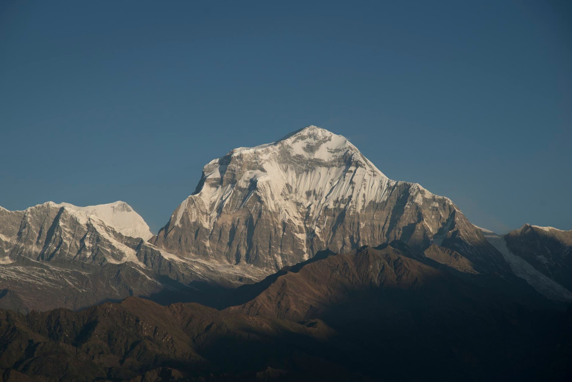
- Dhaulagiri from the pass
- Tarap valley opening
- Day 17
Tokyu to Dho Tarap
Tokyu (4,240 m) → Dho Tarap (4,090 m)
- Distance
- 8 km
- Walking
- 3 hours
- Altitude
- 4,240 m → 4,090 m
- Elevation
- −150 m
- Sleep
- Camp, Dho Tarap
- Meals
- Breakfast, lunch, dinner
- Dho Tarap
- Ribo Bhumpa gompa
- Day 18
Rest day at Dho Tarap
Dho Tarap (4,090 m)
- Walking
- 3 hours
- Altitude
- 4,090 m → 4,090 m
- Sleep
- Camp, Dho Tarap
- Meals
- Breakfast, lunch, dinner
- Day 19
Dho Tarap to Numa La Base Camp
Dho Tarap (4,090 m) → Numa La Base Camp (4,440 m)
- Distance
- 14 km
- Walking
- 6 hours
- Altitude
- 4,090 m → 4,440 m
- Elevation
- +350 m
- Sleep
- Camp, Numa La Base Camp
- Meals
- Breakfast, lunch, dinner
- Day 20
Over Numa La to Pelung Tang
Numa La Base Camp (4,440 m) → Numa La (5,309 m) → Pelung Tang (4,465 m)
- Distance
- 14 km
- Walking
- 8 hours
- Altitude
- 4,440 m → 4,465 m
- Elevation
- +870 m / −845 m
- Sleep
- Camp, Pelung Tang
- Meals
- Breakfast, lunch, dinner
- Numa La at 5
- 309 m
- Dhaulagiri and Churen Himal
- Day 21
Over Baga La to Dajok Tang
Pelung Tang (4,465 m) → Baga La (5,169 m) → Dajok Tang (4,080 m)
- Distance
- 13 km
- Walking
- 7 hours
- Altitude
- 4,465 m → 4,080 m
- Elevation
- +705 m / −1090 m
- Sleep
- Camp, Dajok Tang
- Meals
- Breakfast, lunch, dinner
- Day 22
Dajok Tang to Dunai
Dajok Tang (4,080 m) → Dunai (2,140 m)
- Distance
- 18 km
- Walking
- 7 hours
- Altitude
- 4,080 m → 2,140 m
- Elevation
- −1940 m
- Sleep
- Camp, Dunai
- Meals
- Breakfast, lunch, dinner
- Day 23
Dunai to Juphal, fly to Nepalgunj
Dunai (2,140 m) → Juphal (2,475 m) → Nepalgunj (150 m)
- Distance
- 8 km
- Walking
- 3 hours walking, 35 min flight
- Altitude
- 2,140 m → 150 m
- Sleep
- Hotel, Nepalgunj
- Meals
- Breakfast
- Day 24
Nepalgunj to Kathmandu
Nepalgunj (150 m) → Kathmandu (1,400 m)
- Walking
- 1 hour by air
- Altitude
- 150 m → 1,400 m
- Meals
- Breakfast
Route map
Where the trail goes
Route line, start and end points, and every overnight stop. Locations are shared entities — the same record powers the destination and itinerary pages.
Frequently asked questions
What does Upper Dolpo cost in permits alone?
Why is the season the opposite of everywhere else?
Is this a camping trek?
What is the Crystal Mountain?
How fit do you need to be?
About the author
Tom Eriksen
Gear editor & photographer
Tom tests trekking equipment the only way that produces honest answers: by carrying it for weeks at a time above 4,000 metres. He shoots most of the photography on this site and writes the gear reviews, comparison tables and packing lists.
Writes about: Trekking gear · Photography · Packing and weight