Overview
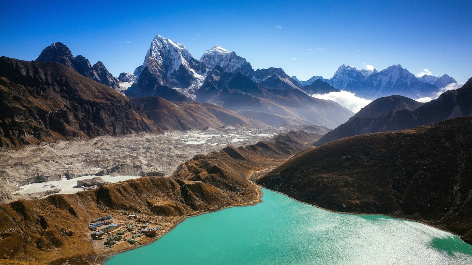
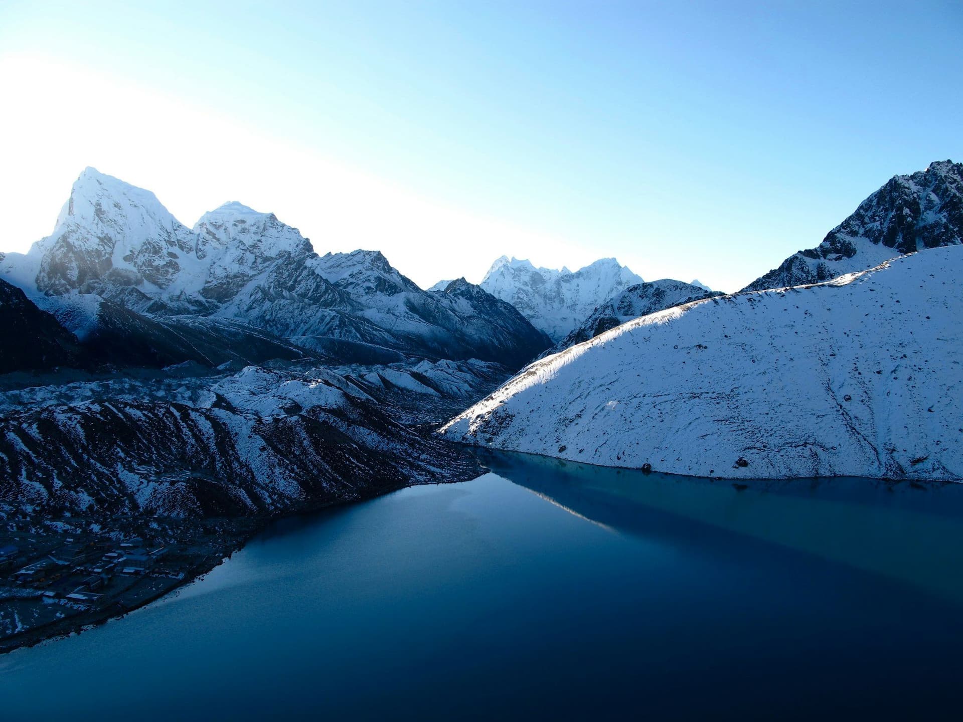
Two valleys drain the south side of the Everest massif. Almost everyone walks up the eastern one to Base Camp. The western one holds the Gokyo lakes — six turquoise tarns strung along the flank of the Ngozumpa glacier at around 4,700 metres, and a small viewpoint above them that happens to show four of the six highest mountains on earth.
The walking is a day shorter than Base Camp, tops out slightly higher at Gokyo Ri, and passes a fraction of the people. The first three days are shared with the Base Camp trail; after Sanasa the crowd turns right and you do not.
Route
From Lukla the route follows the Dudh Kosi to Namche exactly as the Base Camp trek does. Above Sanasa it forks west, climbing over the Mong La saddle into the Dudh Koshi's western branch and up through Dole and Machhermo — both small, both cold, both deliberately spaced to keep the ascent gentle.
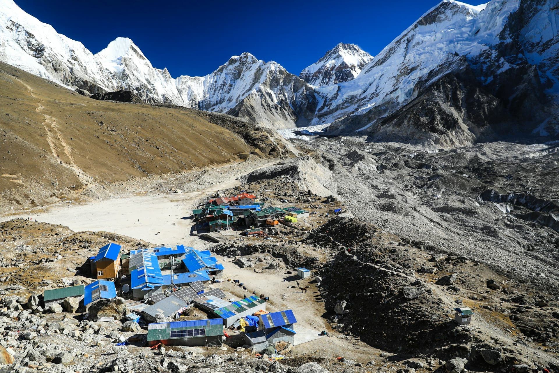
At Gokyo the trail meets the Ngozumpa glacier, the longest in Nepal, and follows its moraine past the first two lakes to the village on the shore of the third. Gokyo Ri rises directly behind it.
The view from Gokyo Ri
Worth being precise about, because it is the reason to come. From the summit at 5,357 m you can see Everest, Lhotse, Makalu and Cho Oyu — four 8,000-metre peaks — with the Ngozumpa glacier below and the lakes behind. Base Camp offers nothing comparable; Everest is not even visible from it.
Most people climb at dawn. Sunset is warmer and quieter, at the cost of descending in the dark with a headtorch.
Acclimatisation
The profile is kinder than Base Camp's but still asks for respect. Two nights at Namche and a short day into Machhermo are what make it work; the Machhermo altitude talk is free, half an hour, and worth attending even if you think you know it all.
The single most common mistake is treating day 7 as a rest day. It is the hardest day of the trek — 900 metres of climbing and descending, all above 4,700 m.
Best season
October and November for the clearest air and the most vivid lake colour. April and May are warmer, hazier, and busier with expedition traffic heading for Cho Oyu. Winter is clear, empty and very cold; several Gokyo lodges close.
Day by day
The 12 days itinerary
Distances, walking times, altitudes and accommodation for every stage — stored as structured data, not written into the prose.
- Day 1
Fly to Lukla, trek to Phakding
Lukla (2,860 m) → Phakding (2,610 m)
- Distance
- 8 km
- Walking
- 3–4 hours
- Altitude
- 2,860 m → 2,610 m
- Elevation
- −250 m
- Sleep
- Teahouse, Phakding
- Meals
- Breakfast, lunch, dinner
- Tenzing–Hillary Airport landing
- Dudh Kosi valley
- Day 2
Phakding to Namche Bazaar
Phakding (2,610 m) → Namche Bazaar (3,440 m)
- Distance
- 10.5 km
- Walking
- 6 hours
- Altitude
- 2,610 m → 3,440 m
- Elevation
- +830 m
- Sleep
- Teahouse, Namche Bazaar
- Meals
- Breakfast, lunch, dinner
- Hillary Suspension Bridge
- Namche Hill
- National park checkpoint
- Day 3
Namche Bazaar — acclimatisation day
Namche → Everest View Hotel (3,880 m) → Namche
- Distance
- 5 km
- Walking
- 3–4 hours
- Altitude
- 3,440 m → 3,440 m
- Elevation
- +440 m / −440 m
- Sleep
- Teahouse, Namche Bazaar
- Meals
- Breakfast, lunch, dinner
The same active rest day the Base Camp route uses, and just as necessary here. Climb to the Everest View Hotel and come back down to sleep.
- Khumjung village
- First Everest view
- Sherpa Culture Museum
- Day 4
Namche to Dole
Namche Bazaar (3,440 m) → Mong La → Dole (4,038 m)
- Distance
- 11 km
- Walking
- 6 hours
- Altitude
- 3,440 m → 4,038 m
- Elevation
- +780 m / −180 m
- Sleep
- Teahouse, Dole
- Meals
- Breakfast, lunch, dinner
The trail splits above Sanasa. Almost everyone goes right towards Tengboche; you go left, and the traffic drops away within the hour.
- Mong La saddle
- Ama Dablam and Thamserku
- The Base Camp crowds turn right
- Day 5
Dole to Machhermo
Dole (4,038 m) → Luza → Machhermo (4,470 m)
- Distance
- 7 km
- Walking
- 4 hours
- Altitude
- 4,038 m → 4,470 m
- Elevation
- +432 m
- Sleep
- Teahouse, Machhermo
- Meals
- Breakfast, lunch, dinner
A deliberately short day. The Himalayan Rescue Association runs a free afternoon altitude talk at Machhermo in season — go to it.
- Cho Oyu appears
- HRA altitude talk
- Day 6
Machhermo to Gokyo
Machhermo (4,470 m) → first and second lakes → Gokyo (4,790 m)
- Distance
- 7 km
- Walking
- 4–5 hours
- Altitude
- 4,470 m → 4,790 m
- Elevation
- +320 m
- Sleep
- Teahouse, Gokyo
- Meals
- Breakfast, lunch, dinner
The trail climbs onto the lateral moraine of the Ngozumpa, the longest glacier in Nepal, then passes the first two lakes before Gokyo appears on the shore of the third.
- Ngozumpa glacier moraine
- First and second lakes
- Third lake and Gokyo village
- Day 7
Gokyo Ri, and the fourth and fifth lakes
Gokyo → Gokyo Ri (5,357 m) → fourth and fifth lakes → Gokyo
- Distance
- 12 km
- Walking
- 7–8 hours
- Altitude
- 4,790 m → 4,790 m
- Elevation
- +900 m / −900 m
- Sleep
- Teahouse, Gokyo
- Meals
- Breakfast, lunch, dinner
Gokyo Ri is a steep 600-metre climb from the village and the best value-for-effort viewpoint in Nepal: four of the world's six highest mountains from a single summit. Afternoon walkers continue past the fourth lake to the fifth and Scoundrel's Viewpoint above it.
- Everest
- Lhotse
- Makalu and Cho Oyu from one summit
- Scoundrel's Viewpoint
- Fifth lake
- Day 8
Gokyo to Dole
Gokyo (4,790 m) → Machhermo → Dole (4,038 m)
- Distance
- 14 km
- Walking
- 6 hours
- Altitude
- 4,790 m → 4,038 m
- Elevation
- −750 m
- Sleep
- Teahouse, Dole
- Meals
- Breakfast, lunch, dinner
- Day 9
Dole to Namche Bazaar
Dole (4,038 m) → Mong La → Namche Bazaar (3,440 m)
- Distance
- 11 km
- Walking
- 6 hours
- Altitude
- 4,038 m → 3,440 m
- Elevation
- −780 m
- Sleep
- Teahouse, Namche Bazaar
- Meals
- Breakfast, lunch, dinner
- Bakeries
- Hot shower
- Thicker air
- Day 10
Namche Bazaar to Lukla
Namche Bazaar (3,440 m) → Lukla (2,860 m)
- Distance
- 19 km
- Walking
- 7–8 hours
- Altitude
- 3,440 m → 2,860 m
- Elevation
- −580 m
- Sleep
- Teahouse, Lukla
- Meals
- Breakfast, lunch, dinner
- Day 11
Fly Lukla to Kathmandu
Lukla (2,860 m) → Kathmandu (1,400 m)
- Walking
- 35-minute flight
- Altitude
- 1,400 m
- Sleep
- Hotel, Kathmandu
- Meals
- Breakfast
- Day 12
Kathmandu — buffer day
Kathmandu (1,400 m)
- Altitude
- 1,400 m
- Sleep
- Hotel, Kathmandu
- Meals
- Breakfast
Kept free for a cancelled Lukla flight. Treat it as part of the plan, not a contingency.
Route map
Where the trail goes
Route line, start and end points, and every overnight stop. Locations are shared entities — the same record powers the destination and itinerary pages.
Frequently asked questions
Gokyo or Everest Base Camp?
How hard is Gokyo Ri?
Can you combine Gokyo with Everest Base Camp?
Are the lakes frozen?
What is the Gokyo Lakes trek?
About the author
Maya Thapa
Senior trekking writer
Maya has walked more than 4,000 kilometres of Nepal's trail network, from the teahouse highways of the Khumbu to the restricted valleys along the Tibetan border. She writes the route guides and day-by-day itineraries, and returns to most trails every second season to re-check lodge availability, water points and trail reroutes after monsoon damage.
Writes about: Nepal trekking · High-altitude routes · Teahouse logistics