Overview
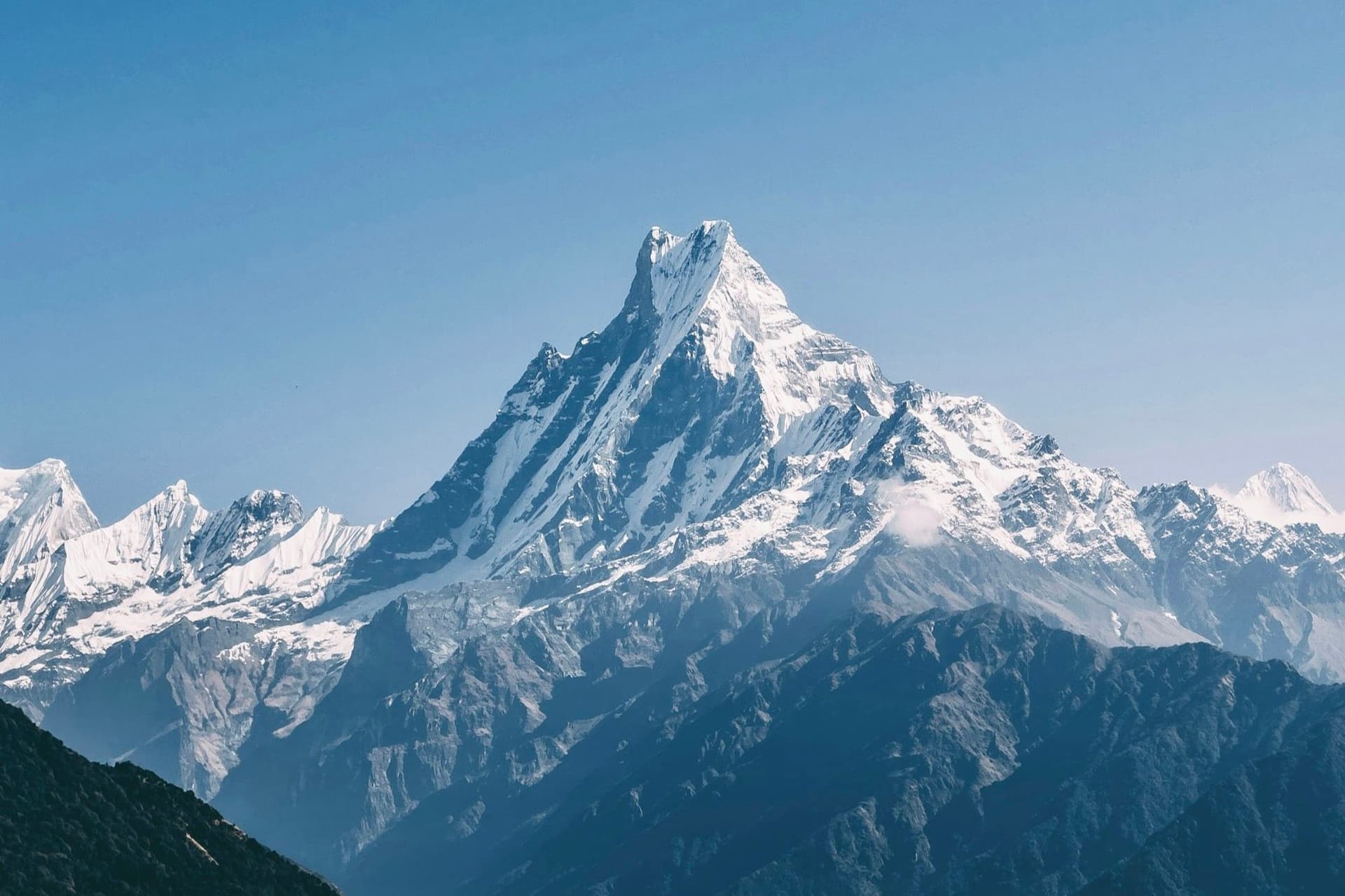
Mardi Himal only opened as a teahouse route in 2012, which is why it feels newer and quieter than everything else in the Annapurna region. It follows a single ridge north from the Pokhara valley, climbing steadily out of forest onto open grass, and finishes at 4,500 metres almost directly beneath the south face of Machhapuchhre.
Five walking days, no pass, no flight, and an hour by road from Pokhara. For the time invested there is no better mountain view in Nepal.
Route
From Kande the trail climbs to Australian Camp and then into deep, mossy rhododendron forest — a long first day with almost no view, which is the price of admission. At Low Camp the forest thins and Machhapuchhre appears ahead and very close.
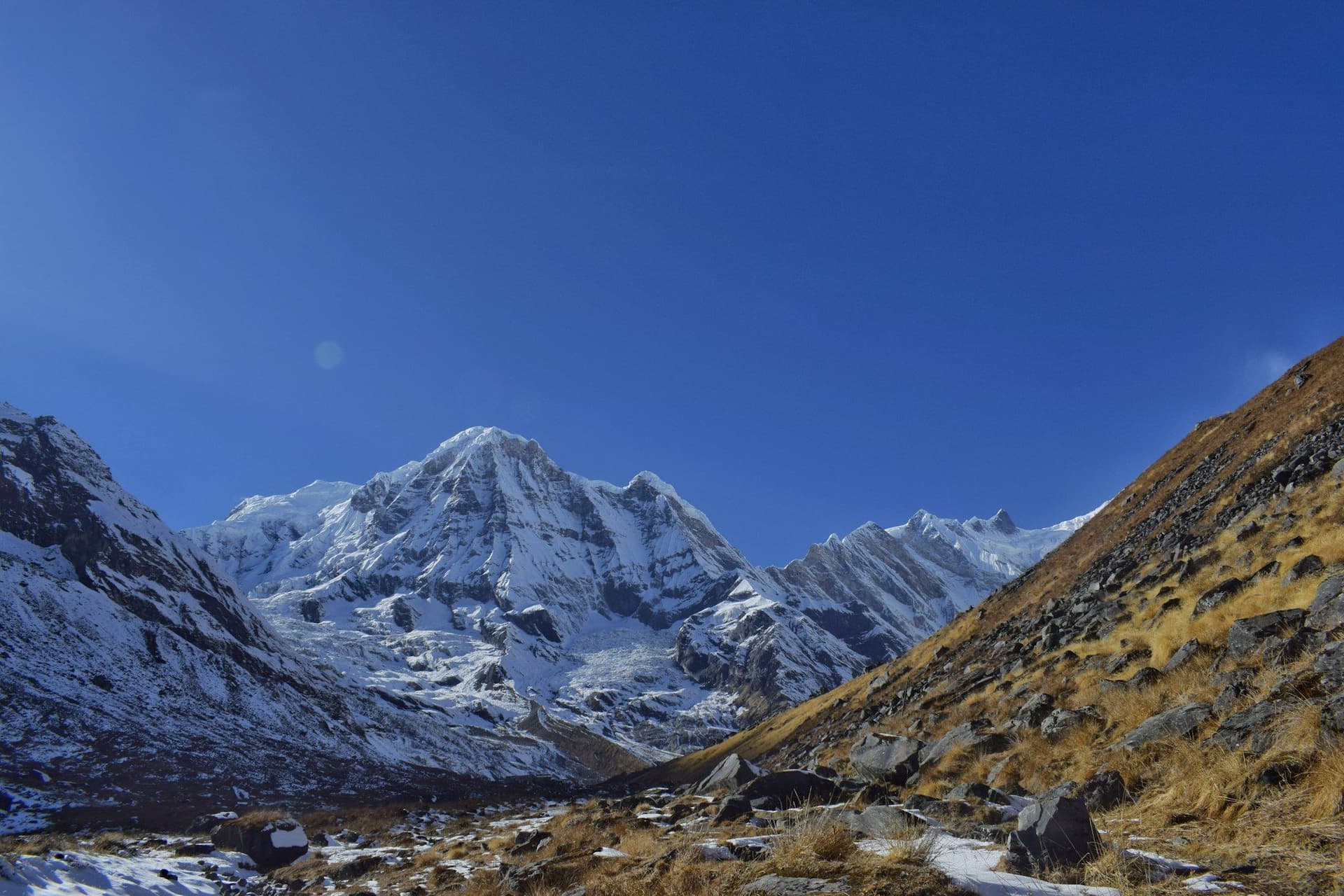
Above High Camp the ridge narrows to a spine with drops on both sides, climbing past a Lower Viewpoint to the Upper Viewpoint at 4,500 m. Annapurna I, Annapurna South, Hiunchuli, Mardi Himal and Machhapuchhre are all in view at once, and the fishtail summit is close enough to see the texture of its ice.
The descent leaves the ridge eastward to Sidhing, so the walk out crosses new ground rather than retracing.
What makes it different
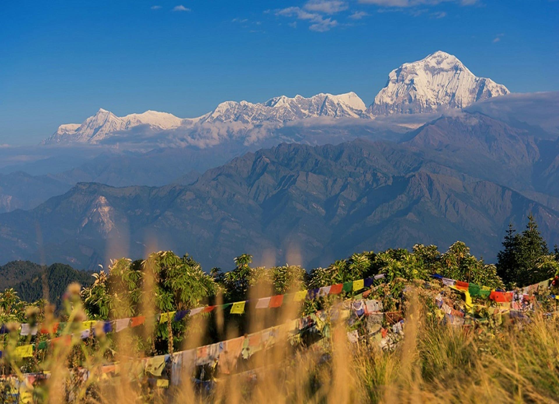
Most Annapurna trekking follows valleys. Mardi follows a ridge, and that changes the experience entirely — you are above the terrain rather than inside it, and in autumn the cloud frequently sits below the trail all afternoon.
The trade-off is exposure. There is no shelter on the top section, and weather arrives quickly.
Practicalities
Lodges are small and, at High Camp, genuinely limited — a dozen or so rooms for the whole ridge. In October and November, ring ahead.
Water is scarce above Low Camp and lodges charge for it. Carry a filter bottle and fill where you can.
Best season
October to December is the most reliable, with the clearest air and the cloud-sea effect at its best. March to May brings rhododendron through the forest section. Winter is walkable to Low Camp but High Camp lodges close, and the monsoon puts the whole ridge in cloud.
Day by day
The 6 days itinerary
Distances, walking times, altitudes and accommodation for every stage — stored as structured data, not written into the prose.
- Day 1
Pokhara to Forest Camp
Kande (1,770 m) → Australian Camp → Pothana → Forest Camp (2,600 m)
- Distance
- 12 km
- Walking
- 6 hours
- Altitude
- 1,770 m → 2,600 m
- Elevation
- +900 m / −70 m
- Sleep
- Teahouse, Forest Camp
- Meals
- Breakfast, lunch, dinner
A long first day through dense forest. Very little view until Low Camp, which makes the following morning all the better.
- Australian Camp viewpoint
- Rhododendron and oak forest
- Moss and lichen woodland
- Day 2
Forest Camp to Low Camp
Forest Camp (2,600 m) → Low Camp (2,970 m)
- Distance
- 6 km
- Walking
- 3–4 hours
- Altitude
- 2,600 m → 2,970 m
- Elevation
- +370 m
- Sleep
- Teahouse, Low Camp
- Meals
- Breakfast, lunch, dinner
A short day, and the one where the trek changes character: the forest thins and Machhapuchhre appears directly ahead, very close.
- First Machhapuchhre view
- Ridge line opens out
- Day 3
Low Camp to High Camp
Low Camp (2,970 m) → Badal Danda → High Camp (3,580 m)
- Distance
- 7 km
- Walking
- 4 hours
- Altitude
- 2,970 m → 3,580 m
- Elevation
- +610 m
- Sleep
- Teahouse, High Camp
- Meals
- Breakfast, lunch, dinner
The rhododendron gives way to open ridge. In autumn the cloud often sits below the ridge all afternoon and you walk above it.
- Above the treeline
- Cloud sea below the ridge
- Annapurna South and Hiunchuli
- Day 4
Upper Viewpoint, descend to Low Camp
High Camp (3,580 m) → Upper Viewpoint (4,500 m) → Low Camp (2,970 m)
- Distance
- 13 km
- Walking
- 8 hours
- Altitude
- 3,580 m → 2,970 m
- Elevation
- +920 m / −1530 m
- Sleep
- Teahouse, Low Camp
- Meals
- Breakfast, lunch, dinner
A pre-dawn start along a narrowing ridge. The Upper Viewpoint at 4,500 m puts you almost underneath Machhapuchhre — close enough that it fills the sky rather than sitting on the horizon. Turn round by mid-morning; the ridge is exposed and the weather closes in.
- Machhapuchhre south face
- Annapurna I
- Mardi Himal
- The narrow summit ridge
- Day 5
Low Camp to Sidhing
Low Camp (2,970 m) → Sidhing (1,700 m)
- Distance
- 9 km
- Walking
- 5 hours
- Altitude
- 2,970 m → 1,700 m
- Elevation
- −1270 m
- Sleep
- Teahouse, Sidhing
- Meals
- Breakfast, lunch, dinner
A steep descent off the east side of the ridge into farmland — a very different landscape from the way up.
- Day 6
Sidhing to Pokhara
Sidhing (1,700 m) → Lumre → Pokhara (822 m)
- Distance
- 4 km
- Walking
- 2 hours walking, 2 hours by road
- Altitude
- 1,700 m → 822 m
- Elevation
- −880 m
- Sleep
- Hotel, Pokhara
- Meals
- Breakfast
Route map
Where the trail goes
Route line, start and end points, and every overnight stop. Locations are shared entities — the same record powers the destination and itinerary pages.
Frequently asked questions
Is Mardi Himal good for a first trek?
How does it compare with Poon Hill?
Do the lodges fill up?
Can you climb Machhapuchhre?
Why Mardi Himal Trek Is the Perfect First Trek — Gear, Costs & What to Expect?
About the author
Maya Thapa
Senior trekking writer
Maya has walked more than 4,000 kilometres of Nepal's trail network, from the teahouse highways of the Khumbu to the restricted valleys along the Tibetan border. She writes the route guides and day-by-day itineraries, and returns to most trails every second season to re-check lodge availability, water points and trail reroutes after monsoon damage.
Writes about: Nepal trekking · High-altitude routes · Teahouse logistics