Overview
The Nar Phu valley runs north from Koto on the Annapurna Circuit, and until 2003 nobody outside it was allowed in. It holds two villages — Phu and Nar — that are Tibetan in language, architecture and religion, and a pass at 5,320 metres that drops you back onto the Circuit at Ngawal.
Ten days. In a good autumn the Circuit below carries thousands of people; this valley carries a few dozen a week.
The valley
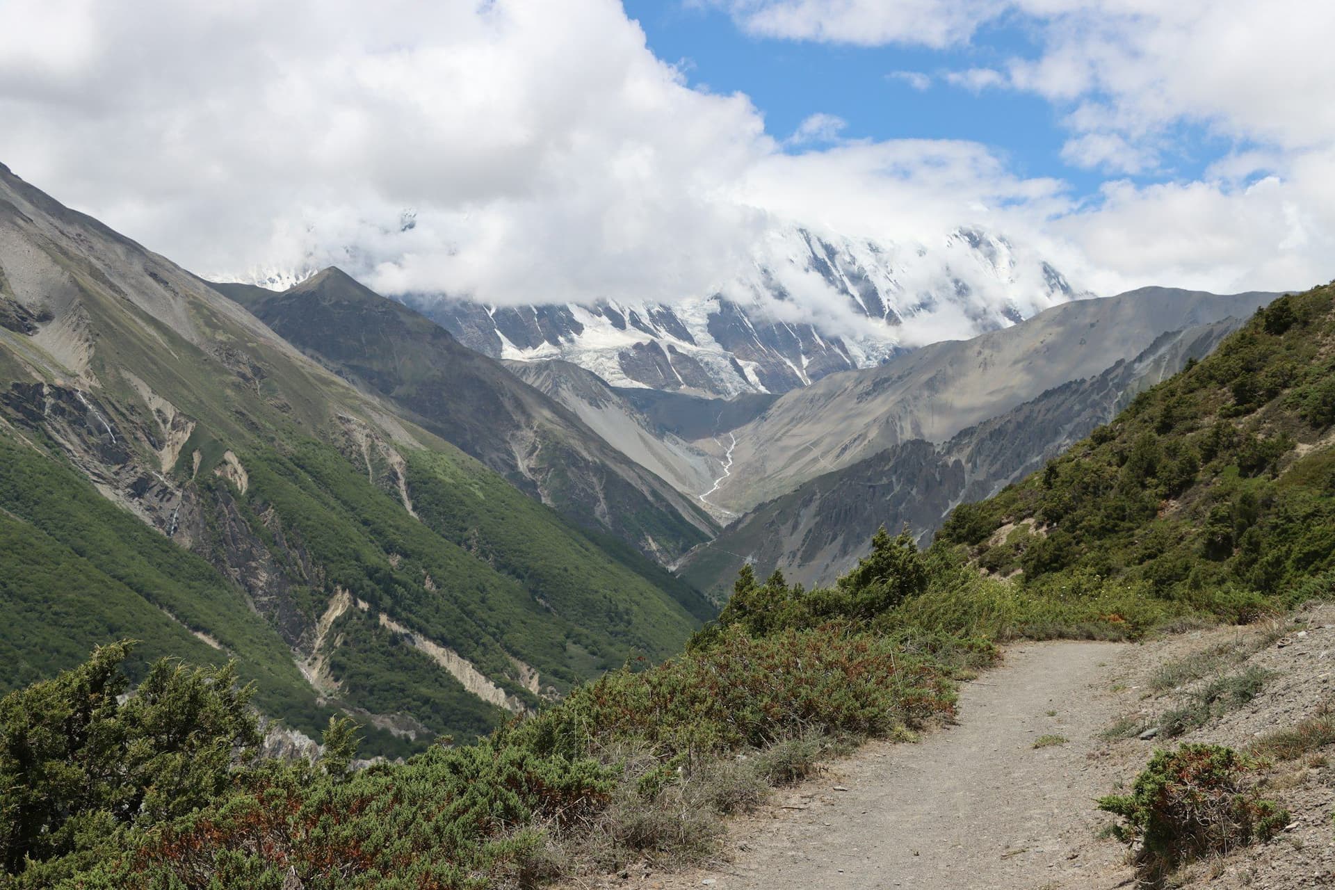
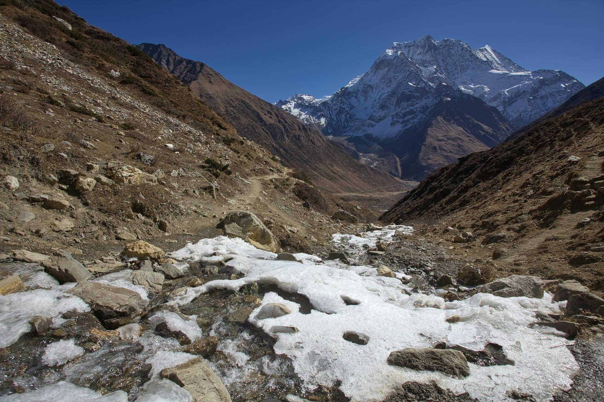
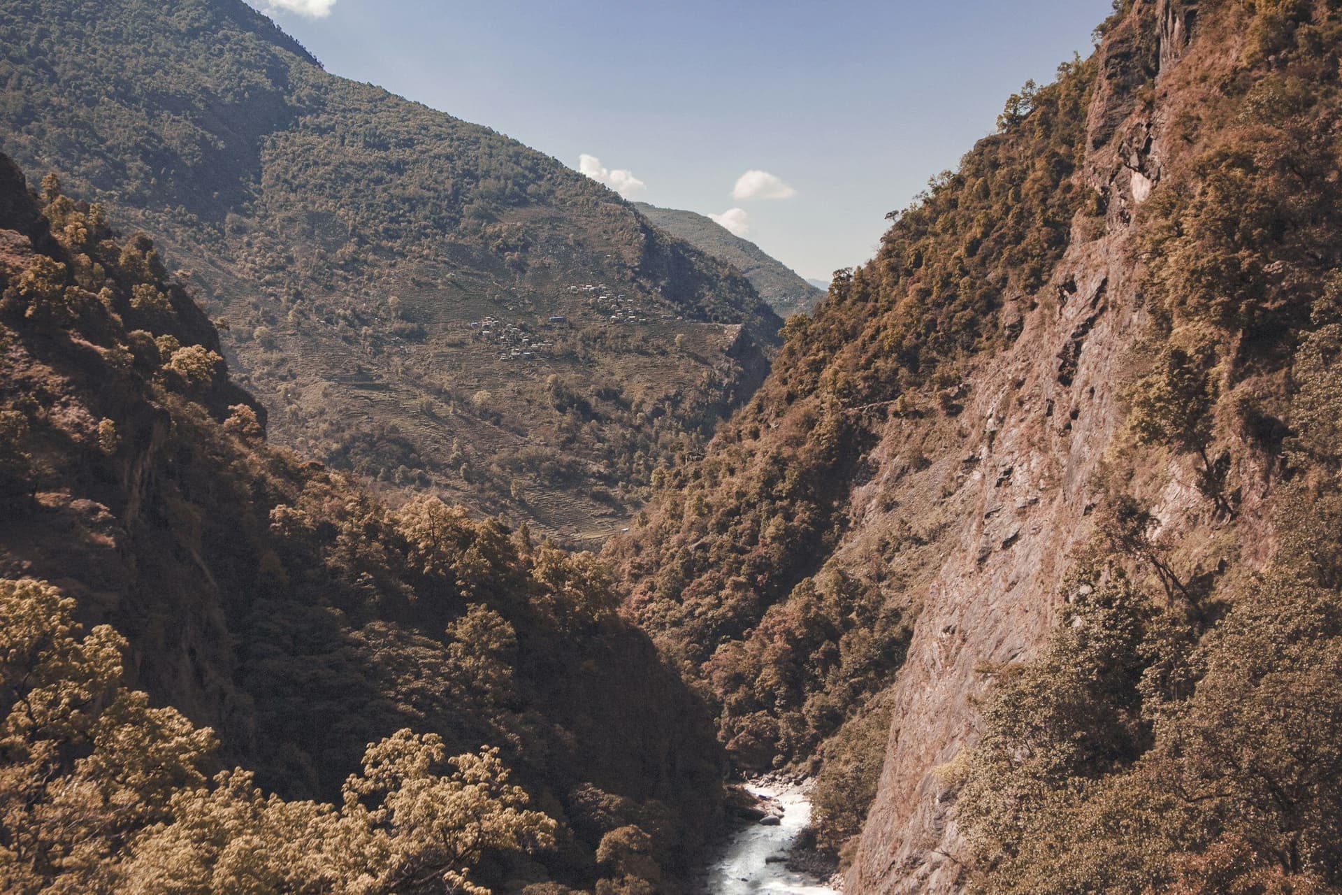
The way in is a gorge — trail blasted into rock, cantilever bridges, and very little sky — for two days. It opens at Meta, and by Phu you are at 4,080 metres in a village of stacked mud-brick houses on a spur, with a ruined dzong above and Himlung Himal closing the head of the valley.
Tashi Lhakhang, the Nyingma monastery above Phu, is among the most important in the region and worth the rest day on its own.
Nar is greener, higher, and announced by four large chortens on the approach.
The Kang La
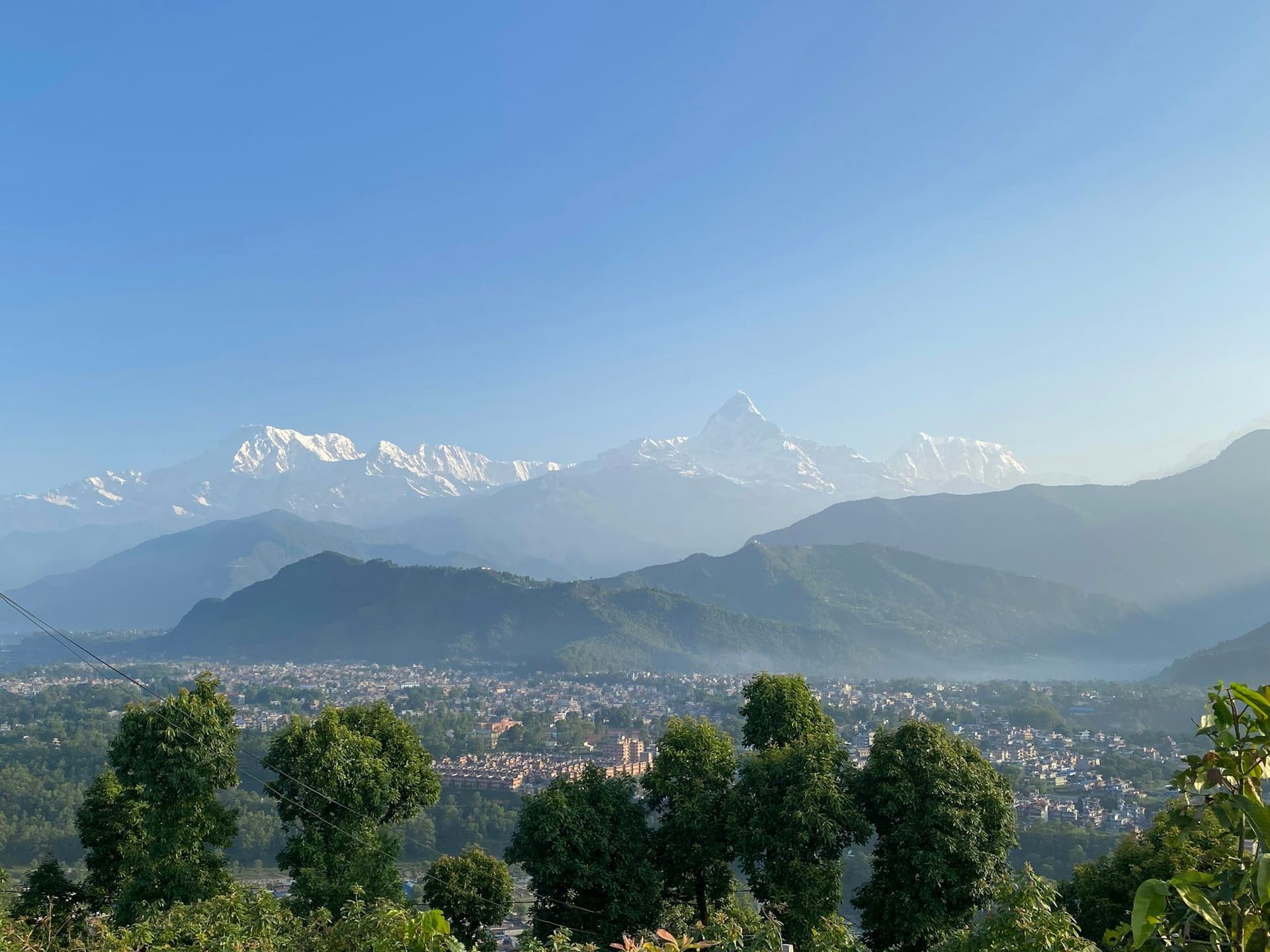
From a cold shelter at 4,530 m, 790 metres up to the Kang La at 5,320 m — higher than Thorong La, and with none of its traffic. The view from the top is the whole Annapurna range across the Manang valley: Annapurna II, III and IV, Gangapurna, Tilicho Peak.
Then 1,660 metres down to Ngawal, which is on the Annapurna Circuit.
The obvious combination
Standing at Ngawal you are on the Circuit. Turning north-west for Manang and the Thorong La instead of driving out makes an eighteen-to-twenty-day route that is, for my money, the best trekking in Nepal — a restricted valley, a hard pass, and then the Circuit's high crossing and Muktinath beyond.
Practicalities
Permits are USD 100 per person per week in the autumn season, USD 75 otherwise, agency-issued with a guide and two trekkers minimum.
Lodges are small and few. Have your guide ring ahead in October.
Best season
September to November and March to May. The Kang La holds snow into spring and takes it early in autumn. Winter closes the villages — most residents move down to Koto and Chame.
Day by day
The 10 days itinerary
Distances, walking times, altitudes and accommodation for every stage — stored as structured data, not written into the prose.
- Day 1
Kathmandu to Koto
Kathmandu (1,400 m) → Besisahar → Koto (2,600 m)
- Walking
- 9 hours by jeep
- Altitude
- 1,400 m → 2,600 m
- Sleep
- Lodge, Koto
- Meals
- Lunch, dinner
A long jeep day up the Marsyangdi. Permits are checked at the Koto police post, where the Nar Phu valley branches north.
- Day 2
Koto to Meta
Koto (2,600 m) → Dharmasala → Meta (3,560 m)
- Distance
- 16 km
- Walking
- 8 hours
- Altitude
- 2,600 m → 3,560 m
- Elevation
- +960 m
- Sleep
- Lodge, Meta
- Meals
- Breakfast, lunch, dinner
A long day through a steep gorge on trail cut into the rock, with several suspension bridges. Meta is the first settlement, seasonally occupied.
- Narrow gorge and cantilever bridges
- First Tibetan chortens
- Day 3
Meta to Phu
Meta (3,560 m) → Kyang → Phu (4,080 m)
- Distance
- 15 km
- Walking
- 7 hours
- Altitude
- 3,560 m → 4,080 m
- Elevation
- +640 m / −120 m
- Sleep
- Lodge, Phu
- Meals
- Breakfast, lunch, dinner
Phu appears at the last moment — a fortified village of stacked mud-brick houses on a rock spur, with a ruined dzong above it.
- Kyang ruins
- The Phu gate
- Fortress village on a spur
- Day 4
Phu — acclimatisation and Tashi Lhakhang
Phu (4,080 m)
- Distance
- 6 km
- Walking
- 4 hours
- Altitude
- 4,080 m → 4,080 m
- Sleep
- Lodge, Phu
- Meals
- Breakfast, lunch, dinner
A rest day, and a walk up to Tashi Lhakhang, one of the region's most important Nyingma monasteries, with Himlung Himal at the head of the valley.
- Tashi Lhakhang gompa
- Himlung Himal
- Blue sheep
- Day 5
Phu to Nar Phedi
Phu (4,080 m) → Nar Phedi (3,490 m)
- Distance
- 14 km
- Walking
- 6 hours
- Altitude
- 4,080 m → 3,490 m
- Elevation
- −590 m
- Sleep
- Monastery guesthouse, Nar Phedi
- Meals
- Breakfast, lunch, dinner
Back down the valley and into the Nar branch. The night is at a working nunnery, which is the only accommodation.
- Day 6
Nar Phedi to Nar
Nar Phedi (3,490 m) → Nar (4,110 m)
- Distance
- 7 km
- Walking
- 4 hours
- Altitude
- 3,490 m → 4,110 m
- Elevation
- +620 m
- Sleep
- Lodge, Nar
- Meals
- Breakfast, lunch, dinner
- Four chortens above the village
- Barley terraces
- Pisang Peak
- Day 7
Nar to Kang La Phedi
Nar (4,110 m) → Kang La Phedi (4,530 m)
- Distance
- 6 km
- Walking
- 4 hours
- Altitude
- 4,110 m → 4,530 m
- Elevation
- +420 m
- Sleep
- Basic shelter, Kang La Phedi
- Meals
- Breakfast, lunch, dinner
A short day to sleep high before the pass. The shelter is minimal and often full; some groups camp.
- Day 8
Kang La to Ngawal
Kang La Phedi (4,530 m) → Kang La (5,320 m) → Ngawal (3,660 m)
- Distance
- 15 km
- Walking
- 9 hours
- Altitude
- 4,530 m → 3,660 m
- Elevation
- +790 m / −1660 m
- Sleep
- Lodge, Ngawal
- Meals
- Breakfast, lunch, dinner
The crux and the payoff. From the pass the entire Annapurna range stands across the Manang valley. Then 1,660 metres of descent on scree.
- Kang La at 5
- 320 m
- Annapurna II
- III and IV
- Gangapurna
- Tilicho Peak
- Day 9
Ngawal to Besisahar
Ngawal (3,660 m) → Manang → Besisahar (760 m)
- Walking
- 7 hours by jeep
- Altitude
- 3,660 m → 760 m
- Sleep
- Guesthouse, Besisahar
- Meals
- Breakfast
Or turn left instead and continue the Annapurna Circuit over Thorong La — see the FAQs.
- Day 10
Besisahar to Kathmandu
Besisahar (760 m) → Kathmandu (1,400 m)
- Walking
- 6 hours by road
- Altitude
- 760 m → 1,400 m
- Meals
- Breakfast
Route map
Where the trail goes
Route line, start and end points, and every overnight stop. Locations are shared entities — the same record powers the destination and itinerary pages.
Frequently asked questions
What does the Nar Phu permit cost?
Can you combine it with the Annapurna Circuit?
How hard is the Kang La?
What are Phu and Nar actually like?
How are the lodges?
About the author
Maya Thapa
Senior trekking writer
Maya has walked more than 4,000 kilometres of Nepal's trail network, from the teahouse highways of the Khumbu to the restricted valleys along the Tibetan border. She writes the route guides and day-by-day itineraries, and returns to most trails every second season to re-check lodge availability, water points and trail reroutes after monsoon damage.
Writes about: Nepal trekking · High-altitude routes · Teahouse logistics